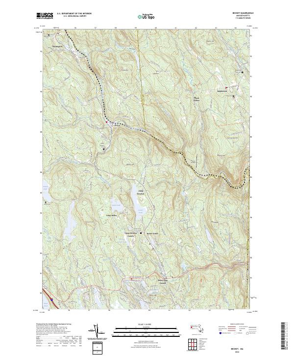
2024 Map of Becket
USGS Topo · Published 2024About this map
Becket and the surrounding Berkshire highlands are defined by a complex network of glacial ponds and mountain brooks. The West Branch Westfield River and its tributaries, such as Yokum Brook and Depot Brook, have historically shaped the settlement patterns of towns like Washington and Middlefield. This modern survey reveals a landscape of recreation and conservation, featuring the Silvio O Conte National Fish and Wildlife Refuge and numerous established youth retreats like Camp Greylock and Camp Becket. Local genealogists will find significant value in the preservation of numerous family and town burial grounds, including the Becket Center Cem and Mack Cem. The road network, including the historic Jacobs Ladder Rd, connects small crossroads like Bonny Rigg Corners to the higher elevations of Crane Hill and Mt Gobble, illustrating the persistent rural character of these hill towns.
Find a feature on this map
139 named features on this map. Tap any name to fly to it.
Don’t see what you’re looking for? This feature index may not catch every label — zoom into the map to look around manually.
Map Details
Editions of this 2024 Becket Map
This is the sole edition of this map. No revisions or reprints were ever made.
Other maps of this area

1886 · Chesterfield
USGS Topo · 1:62,500

1886 · Becket
USGS Topo · 1:62,500

1887 · Granville
USGS Topo · 1:62,500

1888 · Becket
USGS Topo · 1:62,500

1888 · Sandisfield
USGS Topo · 1:62,500

1888 · Chesterfield
USGS Topo · 1:62,500

1889 · Granville
USGS Topo · 1:62,500

1893 · Granville
USGS Topo · 1:62,500

1893 · Chesterfield
USGS Topo · 1:62,500

1893 · Becket
USGS Topo · 1:62,500