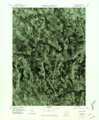
1975 Map of Becket
USGS Topo · Published 1981About this map
The Westfield River carves a deep path through this Berkshire County landscape, where the settlements of Becket and Bancroft follow the valley floor. This 1975 orthophoto reveals the heavy forest cover of the region, punctuated by high-altitude clearings and smaller hamlets such as Becket Center and Bonny Rigg Corners. Unlike standard line maps, this photographic study shows the exact texture of the woodland and the precise footprints of rural homesteads in Middlefield and Washington during the mid-1970s. The concentration of development around the river and rail corridors contrasts sharply with the vast, undeveloped timberlands on the surrounding ridges, providing a clear record of rural land use and the persistent influence of the river on local settlement patterns.
Find a feature on this map
7 named features on this map. Tap any name to fly to it.
Don’t see what you’re looking for? This feature index may not catch every label — zoom into the map to look around manually.
Map Details
Editions of this 1975 Becket Map
This is the sole edition of this map. No revisions or reprints were ever made.
Other maps of this area

1886 · Chesterfield
USGS Topo · 1:62,500

1886 · Becket
USGS Topo · 1:62,500

1887 · Granville
USGS Topo · 1:62,500

1888 · Becket
USGS Topo · 1:62,500

1888 · Sandisfield
USGS Topo · 1:62,500

1888 · Chesterfield
USGS Topo · 1:62,500

1889 · Granville
USGS Topo · 1:62,500

1893 · Granville
USGS Topo · 1:62,500

1893 · Chesterfield
USGS Topo · 1:62,500

1893 · Becket
USGS Topo · 1:62,500