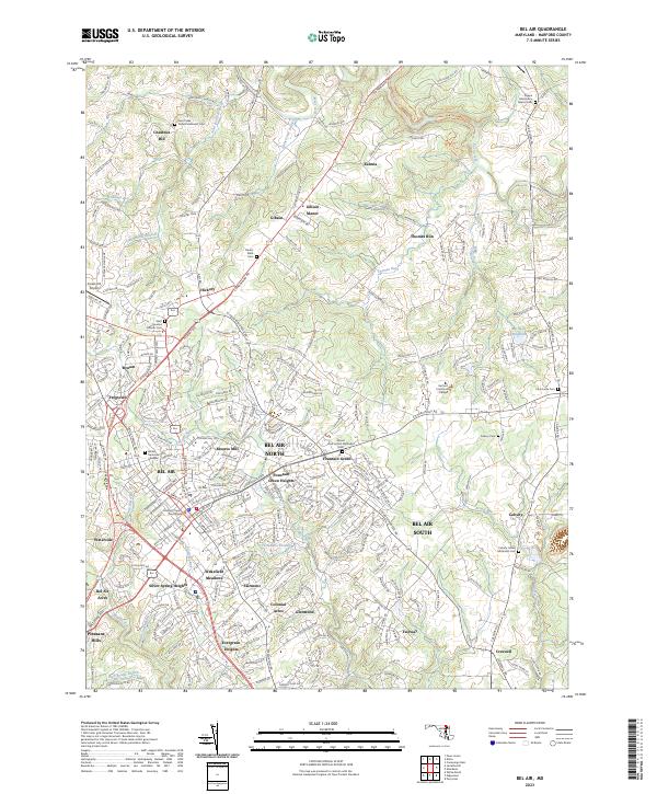
2023 Map of Bel Air
USGS Topo · Published 2023About this map
Bel Air serves as a dense residential and administrative hub, anchored by the Harford County Courthouse and a network of surrounding neighborhoods. The landscape is defined by the drainage systems of Deer Creek and Bynum Run, which have historically shaped the local geography. To the northeast, Michaels Mill (Dam) and Moores Mill point to the area's milling history, while the concentration of cemeteries like Deer Creek United Methodist Cem and Saint Ignatius Catholic Cem provides a significant record for genealogical research. The map illustrates the suburban expansion of Bel Air North and Bel Air South, contrasting with the more dispersed rural character of settlements like Kalmia and Gibson Manor. Educational and civic infrastructure is prominent, notably through the campus of Harford Community College and several local churches that remain central to these Harford County communities.
Find a feature on this map
63 named features on this map. Tap any name to fly to it.
Don’t see what you’re looking for? This feature index may not catch every label — zoom into the map to look around manually.
Map Details
Editions of this 2023 Bel Air Map
This is the sole edition of this map. No revisions or reprints were ever made.
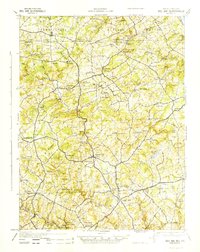
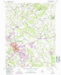
Historical Maps of Harford Hills Through Time
4 maps found