2023 Map of Benedict
USGS Topo · Published 2023About this map
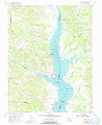
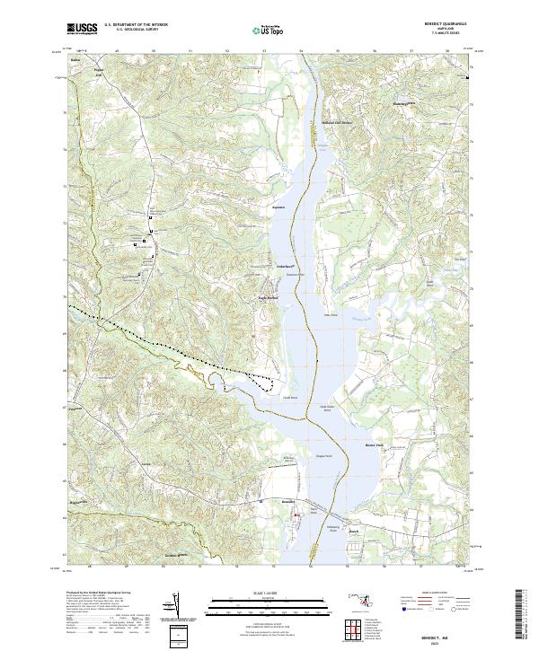
The Patuxent River bisects this Maryland landscape, serving as a natural boundary between Prince George's and Calvert counties. On the western bank, the historically significant community of Eagle Harbor and the nearby Cedarhaven stand near the industrial presence of Chalk Point. The interior reveals a dense concentration of local heritage sites, particularly a series of historic congregations including Saint Philips Episcopal Church and John Wesley Methodist Episcopal Church, each with associated cemeteries that provide deep genealogical value.
Find a feature on this map
151 named features on this map. Tap any name to fly to it.
Don’t see what you’re looking for? This feature index may not catch every label — zoom into the map to look around manually.
Map Details
Editions of this 2023 Benedict Map
This is the sole edition of this map. No revisions or reprints were ever made.