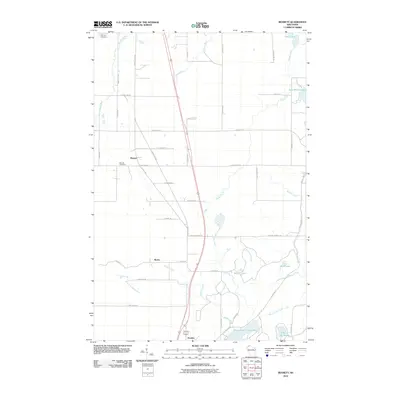
2010 Map of Bennett
USGS Topo · Published 2010About this map
Upper Saint Croix Lake and the surrounding headwaters define this area of Douglas County in the early 21st century. The landscape is marked by the small settlements of Bennett and Beebe, where local history is anchored by the Bennett Cemetery and northern Parkview Cemetery. Transport across this wetland-heavy terrain relies on a network of routes such as S Old 11 Rd and County Hwy-L, which navigate around the numerous glacial lakes and creeks. Notable water bodies include Lake Minnesuing and the secluded Lake of the Woods, while the Poplar River and Middle River flow through the northern reaches. The proximity of Sauntry at the southern edge suggests a connectivity tied to the natural drainage patterns of the Saint Croix Creek and East Fork Moose River.
Find a feature on this map
52 named features on this map. Tap any name to fly to it.
Don’t see what you’re looking for? This feature index may not catch every label — zoom into the map to look around manually.
Map Details
Editions of this 2010 Bennett Map
This is the sole edition of this map. No revisions or reprints were ever made.
Other maps of this area

1945 · Highland
USGS Topo · 1:48,000

1945 · Solon Springs
USGS Topo · 1:48,000

1947 · Brule
USGS Topo · 1:48,000

1949 · Solon Springs
USGS Topo · 1:48,000

1949 · Poplar
USGS Topo · 1:48,000

1949 · Highland
USGS Topo · 1:48,000

1953 · Ashland
USGS Topo · 1:250,000

1954 · Lake Nebagamon
USGS Topo · 1:24,000
1954 · South Range
USGS Topo · 1:24,000
1954 · Lyman Lake
USGS Topo · 1:24,000