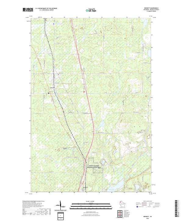
2022 Map of Bennett
USGS Topo · Published 2022About this map
Bennett stands as a central settlement in this northern Wisconsin landscape, situated along a network of country roads including S Old 11 Rd and Bennett Rd. The area is defined by its numerous small waterways and wetlands, notably Merriam Swamp and the headwaters of the Middle River. This 2022 survey documents the contemporary intersection of local history and modern recreation, featuring the Wild Rivers State Trl as it cuts north-south through the terrain. To the south, the village of Sauntry sits near the northern tip of Upper Saint Croix Lake, a significant hydrological feature of Douglas County. For those tracing family history, the map precisely locates several burial grounds, including Lutheran Cem, Bennett Cem, and Old Parkview Cem. The landscape is further characterized by the presence of the North Country National Scenic Trail, which meanders through the eastern sections near Mills Lake and Stone Chimney.
Find a feature on this map
76 named features on this map. Tap any name to fly to it.
Don’t see what you’re looking for? This feature index may not catch every label — zoom into the map to look around manually.
Map Details
Editions of this 2022 Bennett Map
This is the sole edition of this map. No revisions or reprints were ever made.
Other maps of this area

1945 · Highland
USGS Topo · 1:48,000

1945 · Solon Springs
USGS Topo · 1:48,000

1947 · Brule
USGS Topo · 1:48,000

1949 · Solon Springs
USGS Topo · 1:48,000

1949 · Poplar
USGS Topo · 1:48,000

1949 · Highland
USGS Topo · 1:48,000

1953 · Ashland
USGS Topo · 1:250,000

1954 · Lake Nebagamon
USGS Topo · 1:24,000
1954 · South Range
USGS Topo · 1:24,000
1954 · Lyman Lake
USGS Topo · 1:24,000