2023 Map of Benton
USGS Topo · Published 2023About this map
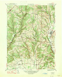
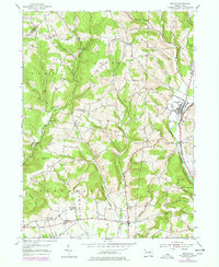
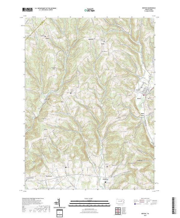
Fishing Creek and its many tributaries, including Little Fishing Creek and West Creek, carve a landscape of alternating ridges and hollows in this 2023 survey of Columbia County. The borough of Benton serves as the primary hub, situated near the Benton Airport and the junction of several rural routes. Smaller, historically distinct settlements like Coles Mill, Derrs, and Rohrsburg are scattered throughout the valley floors, often identified by their proximity to local landmarks such as the Greenwood Methodist Episcopal Church Cem or Waller Cem. The map reveals a deeply entrenched rural network where family and community heritage is preserved in place names like Ardens Hill, O'Brien Hill, and Kramer Hill. The terrain dictates the winding paths of roads like Coles Creek Mill Rd and Waller Divide Rd, illustrating a settlement pattern that remains closely tied to the natural drainage of Green Creek and Little Green Creek.
Find a feature on this map
97 named features on this map. Tap any name to fly to it.
Don’t see what you’re looking for? This feature index may not catch every label — zoom into the map to look around manually.
Map Details
Editions of this 2023 Benton Map
This is the sole edition of this map. No revisions or reprints were ever made.
Historical Maps of Waterville Through Time
3 maps found