
1947 Map of Benton
USGS Topo · Published 1947About this map
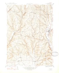
Fishing Creek winds through this 1940s landscape, serving as the primary geographic axis for the settlements of Benton and Stillwater in northern Columbia County. The rural economy of the mid-twentieth century is visible through the concentration of infrastructure at Derrs and the presence of Coles Mill along the waterway. The map provides significant genealogical value for the area, detailing rural institutions like the Greenwood Union Ch and Rohrsburg Cem, alongside small educational centers including Upper Pine Sch and the Consolidated Sch.
Find a feature on this map
41 named features on this map. Tap any name to fly to it.
Don’t see what you’re looking for? This feature index may not catch every label — zoom into the map to look around manually.
Map Details
Editions of this 1947 Benton Map
2 editions found
Other maps of this area

1894 · Bloomsburg
USGS Topo · 1:62,500

1927 · Eagles Mere
USGS Topo · 1:48,000

1932 · Eagle Mere
USGS Topo · 1:62,500

1934 · Laporte
USGS Topo · 1:62,500

1935 · Hughesville
USGS Topo · 1:62,500

1947 · Bloomsburg
USGS Topo · 1:24,000

1947 · Stillwater
USGS Topo · 1:24,000
1947 · Mifflinville
USGS Topo · 1:24,000
1953 · Bloomsburg
USGS Topo · 1:24,000
1953 · Benton
USGS Topo · 1:24,000