Loading...
Loading map...2023 Map of Benton Heights
USGS Topo · Published 2023About this map
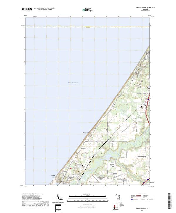
The Paw Paw River winds through this coastal Michigan landscape, framing the industrial and residential development northeast of Benton Harbor. This modern survey illustrates the suburban expansion of Benton Heights and the infrastructure supporting the Southwest Michigan Regional Airport. Along the shoreline of Lake Michigan, distinct lakeside communities like Lake Michigan Beach, Mizpah Park, and Higman Park follow the curve of the lakefront, connected by Lakeshore Ave.
Find a feature on this map
67 named features on this map. Tap any name to fly to it.
Don’t see what you’re looking for? This feature index may not catch every label — zoom into the map to look around manually.
Map Details
Date Portrayed2023
Date Published2023
PublisherU.S. Geological Survey
Map TypeTopographic
Scale1:24000
Physical Dimensions24 x 29 inches
Editions of this 2023 Benton Heights Map
This is the sole edition of this map. No revisions or reprints were ever made.
Historical Maps of Twelve Corners Through Time

Featured Locations
- Benton Charter Township, MI
- Benton Harbor, MI
- Hagar Township, MI
- Benton Heights, Benton Charter Township
- Higman Park, Benton Charter Township
Source Details
SourceU.S. Geological Survey
CopyrightPublic Domain