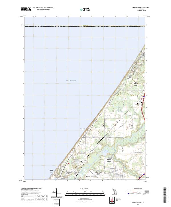
2023 Map of Benton Heights
USGS Topo · Published 2023About this map
The Paw Paw River winds through this coastal Michigan landscape, framing the industrial and residential development northeast of Benton Harbor. This modern survey illustrates the suburban expansion of Benton Heights and the infrastructure supporting the Southwest Michigan Regional Airport. Along the shoreline of Lake Michigan, distinct lakeside communities like Lake Michigan Beach, Mizpah Park, and Higman Park follow the curve of the lakefront, connected by Lakeshore Ave.
Find a feature on this map
67 named features on this map. Tap any name to fly to it.
Don’t see what you’re looking for? This feature index may not catch every label — zoom into the map to look around manually.
Map Details
Editions of this 2023 Benton Heights Map
This is the sole edition of this map. No revisions or reprints were ever made.
Other maps of this area

1927 · Benton Harbor
USGS Topo · 1:62,500

1927 · South Haven
USGS Topo · 1:62,500

1930 · South Haven
USGS Topo · 1:62,500

1930 · Benton Harbor
USGS Topo · 1:62,500

1943 · South Haven
USGS Topo · 1:62,500

1958 · Racine
USGS Topo · 1:250,000

1962 · Racine
USGS Topo · 1:250,000
1970 · Coloma
USGS Topo · 1:24,000
1970 · Benton Harbor
USGS Topo · 1:24,000
1970 · Sodus
USGS Topo · 1:24,000