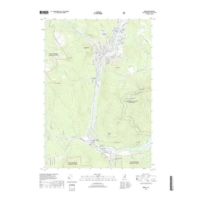
2018 Map of Berlin
USGS Topo · Published 2018About this map
The Androscoggin River carves a deep industrial and transportation corridor through this mountain landscape, anchoring the settlements of Berlin, Cascade, and Gorham. The valley floor is tightly packed with residential streets and infrastructure, including the Old Trunk Line railroad and several historic cemeteries such as Saint Anne Cem and Mount Calvaire Cem. Steep slopes rise sharply from the riverbanks, dominated by summits like Mt Jasper and Mt Hayes.
Find a feature on this map
59 named features on this map. Tap any name to fly to it.
Don’t see what you’re looking for? This feature index may not catch every label — zoom into the map to look around manually.
Map Details
Editions of this 2018 Berlin Map
This is the sole edition of this map. No revisions or reprints were ever made.
Other maps of this area

1893 · Mt. Washington
USGS Topo · 1:62,500

1893 · Gorham
USGS Topo · 1:62,500

1896 · Mt. Washington
USGS Topo · 1:62,500

1896 · Gorham
USGS Topo · 1:62,500

1930 · Milan
USGS Topo · 1:62,500

1930 · Percy
USGS Topo · 1:62,500

1933 · Milan
USGS Topo · 1:62,500

1934 · Percy
USGS Topo · 1:62,500

1934 · Milan
USGS Topo · 1:62,500

1935 · Mt. Washington
USGS Topo · 1:62,500