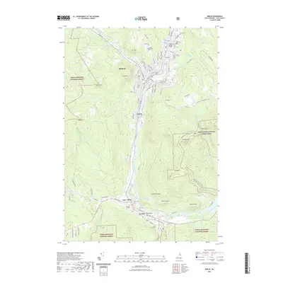
2021 Map of Berlin
USGS Topo · Published 2021About this map
Berlin and its neighboring mill towns dominate the banks of the Androscoggin River in this modern survey of the North Country. The landscape is defined by the steep elevation of the White Mountain National Forest, with peaks like Jericho Mtn, Mt Forest, and Cascade Mtn hemming in the industrial corridor. This map captures the concentrated urban layout of Berlin and Gorham as they appear today, featuring dense neighborhood streets named for European cities and local history, such as Norway St and Denmark St. For genealogists and local historians, the sheet identifies several important resting places, including Calvary Cem, Saint Anne Cem, and Mount Calvaire Cem. The southern reach of the map includes Upper Village and the Gorham Airport, showing how the settlements remain tightly clustered along the river valley floor between the towering ridges of Mt Hayes and Sugar Mtn.
Find a feature on this map
119 named features on this map. Tap any name to fly to it.
Don’t see what you’re looking for? This feature index may not catch every label — zoom into the map to look around manually.
Map Details
Editions of this 2021 Berlin Map
This is the sole edition of this map. No revisions or reprints were ever made.
Other maps of this area

1893 · Mt. Washington
USGS Topo · 1:62,500

1893 · Gorham
USGS Topo · 1:62,500

1896 · Mt. Washington
USGS Topo · 1:62,500

1896 · Gorham
USGS Topo · 1:62,500

1930 · Milan
USGS Topo · 1:62,500

1930 · Percy
USGS Topo · 1:62,500

1933 · Milan
USGS Topo · 1:62,500

1934 · Percy
USGS Topo · 1:62,500

1934 · Milan
USGS Topo · 1:62,500

1935 · Mt. Washington
USGS Topo · 1:62,500