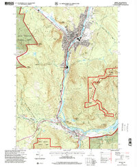
1995 Map of Berlin
USGS Topo · Published 2001About this map
The Androscoggin River carves a deep path through the industrial and residential centers of Berlin and Gorham, defining the economic heart of Coos County. By the mid-1990s, the urban landscape of Berlin shows a dense concentration of civic and religious institutions, including several parochial schools like St Josephs Sch and Notre Dame High Sch, alongside numerous cemeteries like City Cemetery and St Kieran Cemetery. The presence of the St Lawrence and Atlantic RR running parallel to the river underscores the historical importance of the rail-and-water corridor to local industry.
Find a feature on this map
65 named features on this map. Tap any name to fly to it.
Don’t see what you’re looking for? This feature index may not catch every label — zoom into the map to look around manually.
Map Details
Editions of this 1995 Berlin Map
This is the sole edition of this map. No revisions or reprints were ever made.
Other maps of this area

1893 · Mt. Washington
USGS Topo · 1:62,500

1893 · Gorham
USGS Topo · 1:62,500

1896 · Mt. Washington
USGS Topo · 1:62,500

1896 · Gorham
USGS Topo · 1:62,500

1930 · Milan
USGS Topo · 1:62,500

1930 · Percy
USGS Topo · 1:62,500

1933 · Milan
USGS Topo · 1:62,500

1934 · Percy
USGS Topo · 1:62,500

1934 · Milan
USGS Topo · 1:62,500

1935 · Mt. Washington
USGS Topo · 1:62,500