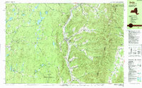
1988 Map of Berlin
USGS Topo · Published 1988About this map
The Little Hoosic River valley serves as the central artery for this late 20th-century survey of the New York, Massachusetts, and Vermont borderlands. The corridor supports a string of settlements from Petersburg in the north through Berlin and Center Berlin to Cherry Plain and Mattison further south. This lowland agricultural and residential ribbon is sharply defined by the massive Taconic Range to the east, where the Taconic Crest Trail follows the ridgeline past Berlin Mtn and the curious geologic feature known as The Snow Hole.
Find a feature on this map
80 named features on this map. Tap any name to fly to it.
Don’t see what you’re looking for? This feature index may not catch every label — zoom into the map to look around manually.
Map Details
Editions of this 1988 Berlin Map
This is the sole edition of this map. No revisions or reprints were ever made.
Other maps of this area

1886 · Greylock
USGS Topo · 1:62,500

1888 · Berlin
USGS Topo · 1:62,500

1890 · Berlin
USGS Topo · 1:62,500

1891 · Greylock
USGS Topo · 1:62,500

1893 · Cohoes
USGS Topo · 1:62,500

1893 · Troy
USGS Topo · 1:62,500

1893 · Greylock
USGS Topo · 1:62,500

1894 · Berlin
USGS Topo · 1:62,500

1895 · Troy
USGS Topo · 1:62,500

1895 · Cohoes
USGS Topo · 1:62,500