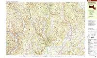
1998 Map of Bernardston
USGS Topo · Published 2000About this map
The B & M RR corridor defines the eastern valley of this landscape, connecting Bernardston and North Bernardston as it follows the path of the Fall River. The western reaches of the quadrangle are marked by the steep terrain of the Colrain and Leyden hills, where numerous brooks like Foundry Brook and Shattuck Brook cut through the highlands toward the North River. This late-twentieth-century survey documents a region where industry and agriculture have long coexisted, evidenced by clusters of development at Foundry Village, Lyonsville, and Griswoldville. For those tracing local heritage, the map identifies several distinct burial grounds, including the Branch Cem and Chandler Hill Cem, alongside public landmarks such as the Leyden Sch. Significant conservation areas, including the Satans Kingdom State Wildlife Management Area and the Darwin Scott Memorial Wetland, suggest a landscape increasingly dedicated to wildlife management and environmental preservation.
Find a feature on this map
108 named features on this map. Tap any name to fly to it.
Don’t see what you’re looking for? This feature index may not catch every label — zoom into the map to look around manually.
Map Details
Editions of this 1998 Bernardston Map
This is the sole edition of this map. No revisions or reprints were ever made.
Other maps of this area

1886 · Hawley
USGS Topo · 1:62,500

1887 · Warwick
USGS Topo · 1:62,500

1889 · Warwick
USGS Topo · 1:62,500

1889 · Wilmington
USGS Topo · 1:62,500

1890 · Hawley
USGS Topo · 1:62,500

1890 · Greenfield
USGS Topo · 1:62,500

1891 · Wilmington
USGS Topo · 1:62,500

1891 · Brattleboro
USGS Topo · 1:62,500

1893 · Brattleboro
USGS Topo · 1:62,500

1894 · Greenfield
USGS Topo · 1:62,500