2022 Map of Berry
USGS Topo · Published 2022About this map
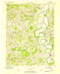
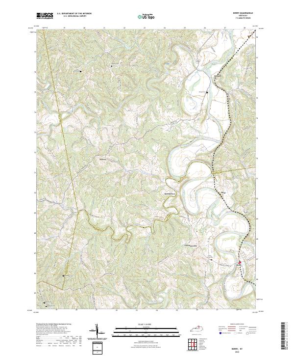
The South Fork Licking River carves a winding path through the borderlands of Harrison, Pendleton, and Grant counties, anchoring a landscape defined by small river-valley settlements and upland farming communities. This map documents the rural character of the region, centered on Berry and the neighboring community of Colemansville. The intricate topography of the area is carved by numerous tributaries, including Fork Lick Creek and Raven Creek, which separate the rolling hills into distinct ridges. Local history is deeply embedded in the land through several family and community landmarks, such as Gum Lick Church and Roanoke Church. Genealogists will find significant value in the distribution of small burial grounds scattered across the quadrangle, from the Pythian Grove Cem near the river to the more isolated Thompson Cem and Robinson Cem. The road network, including the Colemansville-Berry Rd, reflects the historic connections between these established Kentucky hamlets.
Find a feature on this map
79 named features on this map. Tap any name to fly to it.
Don’t see what you’re looking for? This feature index may not catch every label — zoom into the map to look around manually.
Map Details
Editions of this 2022 Berry Map
This is the sole edition of this map. No revisions or reprints were ever made.