2023 Map of Bessemer
USGS Topo · Published 2023About this map
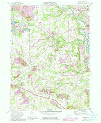
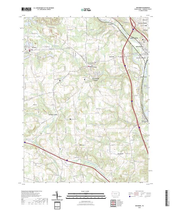
The Mahoning River and Shenango River converge in this corner of Lawrence County, framing a landscape defined by industrial transport and established rural communities. Near the confluence, Mahoningtown and Lawrence Junction serve as focal points for the regional rail-and-river network, while smaller hamlets like Mount Jackson and Moravia are perched on the higher ground between watercourses. The area is dense with legacy sites for genealogists, featuring numerous burial grounds such as Saint Lucy Cem, Valley View Cem, and the Westfield Presbyterian Cem. Cultural landmarks include the S.N.P.J. recreation center and the Mount Jackson Battery B Methodist Episcopal Church. To the west, the borough of Bessemer anchors the landscape, while Reno Airport and the surrounding runs, including Beaverdam Run, illustrate the varied topography of western Pennsylvania.
Find a feature on this map
78 named features on this map. Tap any name to fly to it.
Don’t see what you’re looking for? This feature index may not catch every label — zoom into the map to look around manually.
Map Details
Editions of this 2023 Bessemer Map
This is the sole edition of this map. No revisions or reprints were ever made.