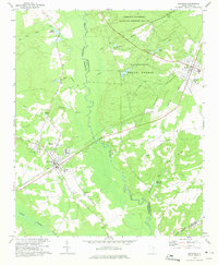
1970 Map of Bethune
USGS Topo · Published 1975About this map
Bethune and McBee serve as the primary population centers in this 1970 snapshot of the South Carolina sandhills. The landscape is defined by the Seaboard Coast Line railroad, which cuts a straight path through the region, anchoring the local economy and transportation network. Extensive public lands, including the Carolina Sandhills National Wildlife Refuge and Sandhills State Forest, dominate the northeastern and central sections, preserving the characteristic sandy terrain and pine barrens.
Find a feature on this map
36 named features on this map. Tap any name to fly to it.
Don’t see what you’re looking for? This feature index may not catch every label — zoom into the map to look around manually.
Map Details
Editions of this 1970 Bethune Map
This is the sole edition of this map. No revisions or reprints were ever made.
Other maps of this area

1941 · Spartanburg
USGS Topo · 1:250,000

1953 · Spartanburg
USGS Topo · 1:250,000

1960 · Spartanburg
USGS Topo · 1:250,000

1963 · Spartanburg
USGS Topo · 1:250,000

1964 · Spartanburg
USGS Topo · 1:250,000

1967 · Angelus
USGS Topo · 1:24,000

1967 · Mount Pisgah
USGS Topo · 1:24,000

1968 · Middendorf
USGS Topo · 1:24,000
1968 · Lake Robinson
USGS Topo · 1:24,000

1968 · Kellytown
USGS Topo · 1:24,000