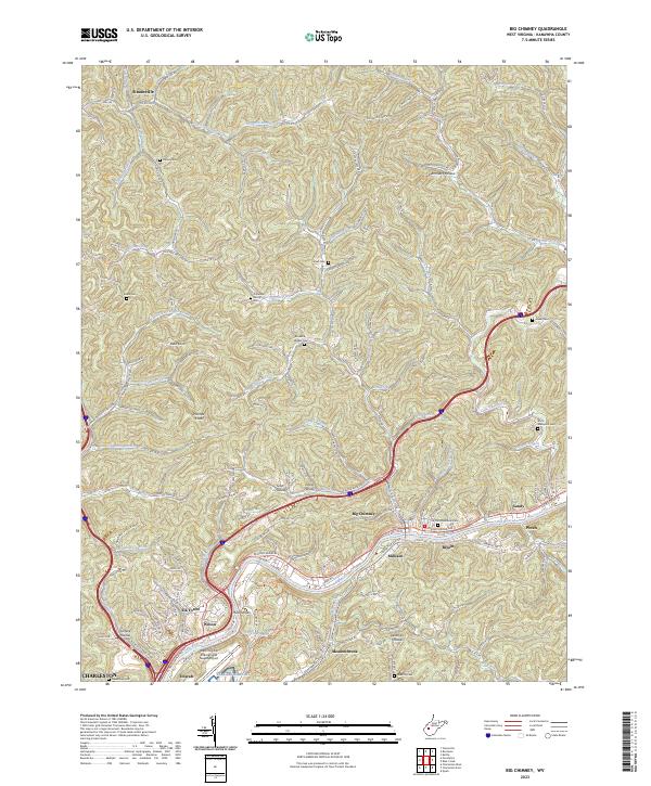
2023 Map of Big Chimney
USGS Topo · Published 2023About this map
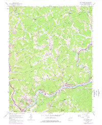
Elk River serves as the central artery for this region of Kanawha County, its winding path followed closely by the Elk River Railroad and a string of riverside communities including Big Chimney, Bream, and Milliken. The terrain is defined by a dense network of steep hollows and ridges, such as Scott Hollow and Tarkin Hollow, where development is concentrated along narrow creek bottoms. In the south, the massive footprint of the West Virginia International Yeager Airport marks a sharp contrast to the more traditional settlement patterns found further north in Sissonville and Pinch. Numerous family burying grounds, including the Cavender Family Cem and Burdette Walker Cem, are scattered across the hillsides, providing significant genealogical touchstones for families from Etowah and Mink Shoals. The transition from the urban edge of Charleston to the hollows of Hammack Hollow and Surface Hollow illustrates the enduring topography of the West Virginia landscape.
Find a feature on this map
164 named features on this map. Tap any name to fly to it.
Don’t see what you’re looking for? This feature index may not catch every label — zoom into the map to look around manually.
Map Details
Editions of this 2023 Big Chimney Map
This is the sole edition of this map. No revisions or reprints were ever made.
Historical Maps of Aarons Through Time
3 maps found