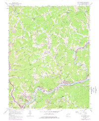
1958 Map of Big Chimney
USGS Topo · Published 1978About this map
The Elk River winds through the heart of this landscape, anchoring a series of small settlements and transportation corridors just north of the state capital. By the late 1950s, the region reflected a mix of traditional hill-country life and burgeoning suburban infrastructure, seen in the proximity of established communities like Big Chimney and Milliken to the expanding Kanawha Airport and Coonskin Park. The complex topography is carved by numerous tributaries such as Sandy Creek and Coopers Creek, which provided natural pathways for the Baltimore and Ohio railroad and various secondary roads.
Find a feature on this map
92 named features on this map. Tap any name to fly to it.
Don’t see what you’re looking for? This feature index may not catch every label — zoom into the map to look around manually.
Map Details
Editions of this 1958 Big Chimney Map
4 editions found
Other maps of this area

1897 · Kanawha Falls
USGS Topo · 1:125,000

1899 · Charleston
USGS Topo · 1:125,000

1900 · Kanawha Falls
USGS Topo · 1:125,000

1901 · Kanawha Falls
USGS Topo · 1:125,000

1906 · Kenna
USGS Topo · 1:62,500

1906 · Walton
USGS Topo · 1:62,500

1907 · Kenna
USGS Topo · 1:62,500

1907 · Walton
USGS Topo · 1:62,500

1907 · Clendenin
USGS Topo · 1:62,500

1909 · Charleston
USGS Topo · 1:62,500