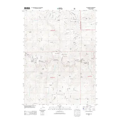
2013 Map of Big Narrows
USGS Topo · Published 2013About this map
Roosevelt National Forest surrounds the high-elevation landscape where the Cache la Poudre River winds through narrow canyons and mountain flats. This 2013 survey provides a clear view of the recreational and residential footprints in the area, from the community of Eggers to the gathering point at Stove Prairie Landing. The map is particularly useful for those tracing local family history and mountain settlement, as it explicitly identifies the Bosworth Homestead, Clark Homestead, and Lewis Ranch. Genealogy researchers will find unique value in the recorded locations of solitary burial sites such as the Azuba Batterson Grave and Kitty Lyon Grave, along with the Adams Cem. Steep canyon walls at Big Narrows and peaks like Mount McConnel define the geography, while numerous campgrounds like Kelly Flats Campground indicate the enduring draw of the South Fork Cache la Poudre River.
Find a feature on this map
68 named features on this map. Tap any name to fly to it.
Don’t see what you’re looking for? This feature index may not catch every label — zoom into the map to look around manually.
Map Details
Editions of this 2013 Big Narrows Map
This is the sole edition of this map. No revisions or reprints were ever made.
Other maps of this area

1907 · Livermore
USGS Topo · 1:125,000

1909 · Livermore
USGS Topo · 1:125,000

1916 · Home
USGS Topo · 1:125,000

1920 · Home
USGS Topo · 1:125,000

1954 · Greeley
USGS Topo · 1:250,000

1957 · Greeley
USGS Topo · 1:250,000

1958 · Greeley
USGS Topo · 1:250,000

1960 · Haystack Gulch
USGS Topo · 1:24,000

1960 · Livermore Mountain
USGS Topo · 1:24,000

1961 · Greeley
USGS Topo · 1:250,000