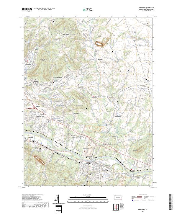
2023 Map of Birdsboro
USGS Topo · Published 2023About this map
Birdsboro and the surrounding Berks County landscape are defined by the winding course of the Schuylkill River and the historical industrial infrastructure that follows it. The southern portion of the map reveals the Schuylkill Canal and the Schuylkill River Water Trl passing through the heart of town, shadowed by the steep elevations of Furnace Hill and Cedar Hill. Numerous small settlements like Baumstown, Gibraltar, and Stonetown dot the valleys, connected by the historical Perkiomen Ave and Boyertown Pike.
Find a feature on this map
87 named features on this map. Tap any name to fly to it.
Don’t see what you’re looking for? This feature index may not catch every label — zoom into the map to look around manually.
Map Details
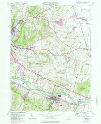
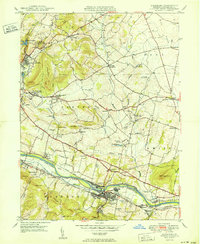
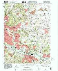
Editions of this 2023 Birdsboro Map
This is the sole edition of this map. No revisions or reprints were ever made.
Historical Maps of Jacksonwald Through Time
4 maps found
Featured Locations
- Alsace Township, PA
- Birdsboro, PA
- Oley Township, PA
- Hohls Crossing, Robeson Township
- Village of Jacksonwald, Exeter Township