2023 Map of Black Diamond
USGS Topo · Published 2023About this map
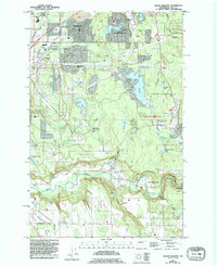
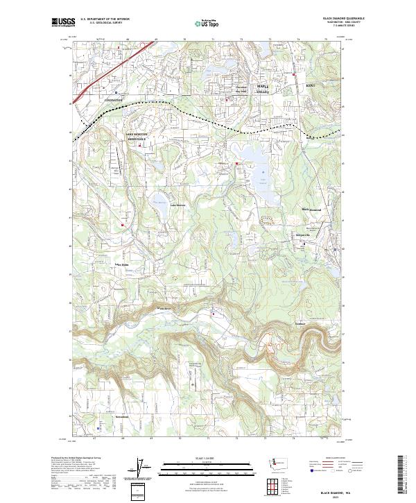
The Green River carves a deep valley through the southern portion of this region, separating the residential growth of Covington and Maple Valley from the historic coal-mining corridor near Black Diamond. The landscape is defined by its glacial hydrology, with numerous basins like Lake Sawyer, Lake Morton, and the protected Mooney Swamp shaping the layout of local roads and neighborhoods. Small settlements such as Morganville and Kummer persist as distinct localities, while aviation history is represented by several local strips including Black Diamond Airport and Norman Grier Field. The Black Diamond Cem remains a significant site for local genealogy, marking the community's roots near the banks of Rock Creek.
Find a feature on this map
107 named features on this map. Tap any name to fly to it.
Don’t see what you’re looking for? This feature index may not catch every label — zoom into the map to look around manually.
Map Details
Editions of this 2023 Black Diamond Map
This is the sole edition of this map. No revisions or reprints were ever made.