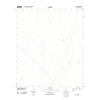
2011 Map of Black Hills
USGS Topo · Published 2011About this map
Vaca Hills and the prominent Black Hills anchor this desert landscape within the Schuk Toak District during the early 21st century. The terrain is defined by a series of alluvial washes and drainage patterns that descend from these elevations toward Coyote Field. This 2011 survey captures the area when human presence was limited to remote outposts like the San Ignacio Ranch and the solitary path of Indian Rte 35 traversing the eastern portion of the quadrangle. Significant elevation markers such as Proctor Hill rise above the surrounding flats, providing distinct landmarks in an otherwise sparse and open desert environment. The map details the subtle natural topography and thin network of local roads that serve these isolated ranching and tribal lands.
Find a feature on this map
6 named features on this map. Tap any name to fly to it.
Don’t see what you’re looking for? This feature index may not catch every label — zoom into the map to look around manually.
Map Details
Editions of this 2011 Black Hills Map
This is the sole edition of this map. No revisions or reprints were ever made.
Other maps of this area

1934 · Silver Bell
USGS Topo · 1:125,000

1937 · Comobabi
USGS Topo · 1:48,000

1938 · San Vicente
USGS Topo · 1:62,500

1941 · San Vicente
USGS Topo · 1:62,500

1942 · San Vicente
USGS Topo · 1:62,500

1942 · Comobabi
USGS Topo · 1:62,500

1948 · San Vicente
USGS Topo · 1:62,500

1956 · Tucson
USGS Topo · 1:250,000

1958 · Tucson
USGS Topo · 1:250,000

1959 · Tucson
USGS Topo · 1:250,000