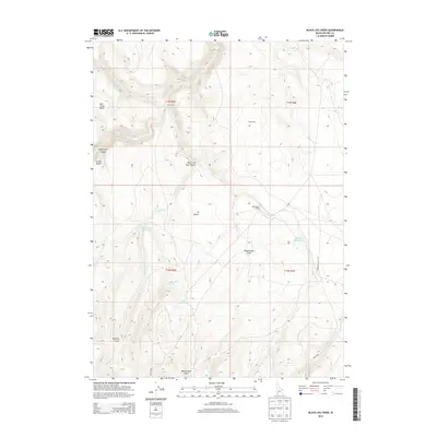
2013 Map of Black Leg Creek
USGS Topo · Published 2013About this map
J-P Desert and the high sagebrush plains of Owyhee County define this landscape as it appeared in 2013. The area is marked by dramatic drainages including Sheep Trail Canyon and Black Leg Box Canyon, which cut through the high plateau. Human presence is sparse, concentrated at outposts like Three Forks and the Tokembamy Ranch. Water management is critical in this arid environment, evidenced by the presence of Black Leg Reservoir and Billings Reservoir, along with isolated water sources like Rizzi Spring and Willow Spring. These features suggest a landscape primarily utilized for seasonal ranching and grazing. The complex network of ephemeral streams, such as Black Leg Creek and Cottonwood Creek, flows toward deeply incised draws like Rattlesnake Draw and Whiskey Draw, illustrating the erosive forces at work in the Idaho high desert.
Find a feature on this map
27 named features on this map. Tap any name to fly to it.
Don’t see what you’re looking for? This feature index may not catch every label — zoom into the map to look around manually.
Map Details
Editions of this 2013 Black Leg Creek Map
This is the sole edition of this map. No revisions or reprints were ever made.
Other maps of this area

1936 · Mountain City
USGS Topo · 1:62,500

1936 · Rowland
USGS Topo · 1:48,000

1940 · Rowland
USGS Topo · 1:62,500

1940 · Mountain City
USGS Topo · 1:62,500

1955 · Twin Falls
USGS Topo · 1:250,000

1955 · Wells
USGS Topo · 1:250,000

1958 · Wells
USGS Topo · 1:250,000

1958 · Twin Falls
USGS Topo · 1:250,000

1961 · Wells
USGS Topo · 1:250,000
1979 · Antelope Creek
USGS Topo · 1:24,000