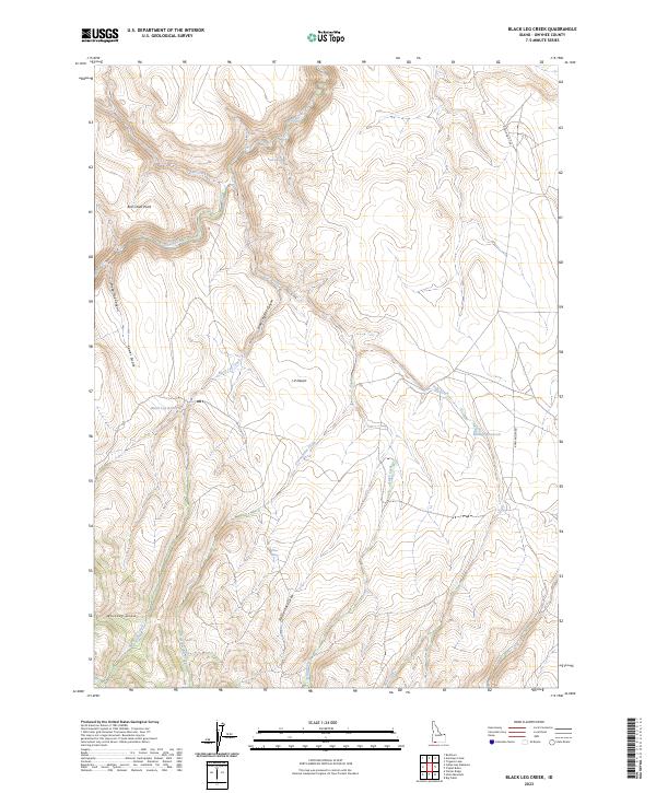
2023 Map of Black Leg Creek
USGS Topo · Published 2023About this map
Black Leg Creek carves a path through this high-elevation corner of Owyhee County, where the landscape is defined by its drainages and arid uplands. The terrain is notably rugged, featuring deep incisions like Black Leg Box Canyon and Sheep Trail Canyon that contrast with the open expanse of the J-P Desert. Evidence of water management for livestock or local use is clear through the presence of Black Leg Reservoir and Billings Reservoir, along with isolated water sources like Rizzi Spring and Willow Spring.
Find a feature on this map
22 named features on this map. Tap any name to fly to it.
Don’t see what you’re looking for? This feature index may not catch every label — zoom into the map to look around manually.
Map Details
Editions of this 2023 Black Leg Creek Map
This is the sole edition of this map. No revisions or reprints were ever made.
Other maps of this area

1936 · Mountain City
USGS Topo · 1:62,500

1936 · Rowland
USGS Topo · 1:48,000

1940 · Rowland
USGS Topo · 1:62,500

1940 · Mountain City
USGS Topo · 1:62,500

1955 · Twin Falls
USGS Topo · 1:250,000

1955 · Wells
USGS Topo · 1:250,000

1958 · Wells
USGS Topo · 1:250,000

1958 · Twin Falls
USGS Topo · 1:250,000

1961 · Wells
USGS Topo · 1:250,000
1979 · Antelope Creek
USGS Topo · 1:24,000