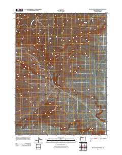
2011 Map of Black Rock Springs
USGS Topo · Published 2011About this map
Lone Mountain dominates the high desert landscape of Harney County in this 2011 record of southeastern Oregon. The terrain is defined by its scarce water sources, where isolated points like Black Rock Spring and Indian Spring served as vital landmarks for early livestock grazing and regional travel. To the northwest, the seasonal drainage of Long Hollow Creek carves through the arid landscape, illustrating the hydrological patterns of the northern Great Basin. The map captures a largely unsettled area where the road network consists primarily of unimproved trails and four-wheel-drive paths, reflecting the enduring character of this corner of the state's interior. This survey is a precise documentation of topographic elevations and water locations essential for navigating the high plateau before modern developments significantly altered the landscape.
Find a feature on this map
4 named features on this map. Tap any name to fly to it.
Don’t see what you’re looking for? This feature index may not catch every label — zoom into the map to look around manually.
Map Details
Editions of this 2011 Black Rock Springs Map
This is the sole edition of this map. No revisions or reprints were ever made.
Other maps of this area

1886 · Disaster
USGS Topo · 1:250,000

1889 · Long Valley
USGS Topo · 1:250,000

1893 · Disaster
USGS Topo · 1:250,000

1954 · Vya
USGS Topo · 1:250,000

1955 · Adel
USGS Topo · 1:250,000

1957 · Adel
USGS Topo · 1:250,000

1958 · Vya
USGS Topo · 1:250,000

1958 · Adel
USGS Topo · 1:250,000

1962 · Vya
USGS Topo · 1:250,000

1962 · Adel
USGS Topo · 1:250,000