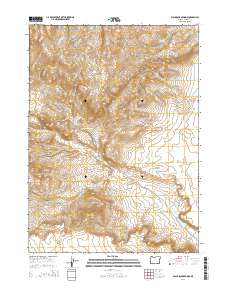
2014 Map of Black Rock Springs
USGS Topo · Published 2014About this map
Lone Mtn rises as a prominent landmark in this high-elevation landscape of southeast Oregon, surveyed during the early 21st century. The terrain is defined by a series of drainage systems and peaks, including the prominent Twin Peak in the southern reaches and the expansive Long Draw to the west. Water sources are sparse but critical in this arid environment, marked by the naming of Black Rock Springs and the seasonal flow indicated at Long Hollow Cr. The map's grid layout, encompassing portions of t40s r32e, t40s r33e, t41s r32e, and t41s r33e, illustrates the vast, undeveloped character of this section of Harney County, where natural topography and elevation contours dictate the movement across the land.
Find a feature on this map
9 named features on this map. Tap any name to fly to it.
Don’t see what you’re looking for? This feature index may not catch every label — zoom into the map to look around manually.
Map Details
Editions of this 2014 Black Rock Springs Map
This is the sole edition of this map. No revisions or reprints were ever made.
Other maps of this area

1886 · Disaster
USGS Topo · 1:250,000

1889 · Long Valley
USGS Topo · 1:250,000

1893 · Disaster
USGS Topo · 1:250,000

1954 · Vya
USGS Topo · 1:250,000

1955 · Adel
USGS Topo · 1:250,000

1957 · Adel
USGS Topo · 1:250,000

1958 · Vya
USGS Topo · 1:250,000

1958 · Adel
USGS Topo · 1:250,000

1962 · Vya
USGS Topo · 1:250,000

1962 · Adel
USGS Topo · 1:250,000