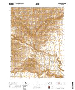
2020 Map of Black Rock Springs
USGS Topo · Published 2020About this map
Lone Mtn rises as a central landmark in this high-desert portion of Harney County, Oregon, where the landscape is defined by its dramatic topographic relief and intermittent drainage systems. The survey details the winding path of Long Hollow Cr and the deep incision of Long Draw in the northwestern quadrant, illustrating the erosional patterns characteristic of this arid region. Human presence is represented almost exclusively by the remote path of Oregon End Table Rd, which traverses the township lines and serves as the primary artery through this sparsely populated territory. The map provides clear evidence of the Public Land Survey System structure, with distinct township and range sections like t40s r32e and t41s r32e guiding the division of the terrain south toward Twin Peak.
Find a feature on this map
9 named features on this map. Tap any name to fly to it.
Don’t see what you’re looking for? This feature index may not catch every label — zoom into the map to look around manually.
Map Details
Editions of this 2020 Black Rock Springs Map
This is the sole edition of this map. No revisions or reprints were ever made.
Other maps of this area

1886 · Disaster
USGS Topo · 1:250,000

1889 · Long Valley
USGS Topo · 1:250,000

1893 · Disaster
USGS Topo · 1:250,000

1954 · Vya
USGS Topo · 1:250,000

1955 · Adel
USGS Topo · 1:250,000

1957 · Adel
USGS Topo · 1:250,000

1958 · Vya
USGS Topo · 1:250,000

1958 · Adel
USGS Topo · 1:250,000

1962 · Vya
USGS Topo · 1:250,000

1962 · Adel
USGS Topo · 1:250,000