2021 Map of Blairstown
USGS Topo · Published 2021About this map
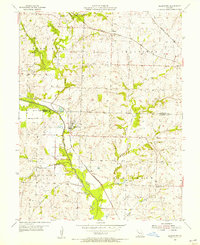
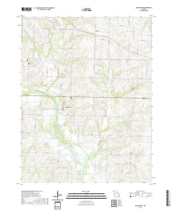
Blairstown and the surrounding rural landscapes of Henry and Johnson counties are defined by a network of creeks and a converted rail corridor. The community of Blairstown sits just south of the Old Channel Big Cr, where the landscape shifts into the broader valley of Big Creek. This modern survey documents the Rock Island Spur Trl cutting across the northern portion of the quadrangle through Denton, tracing the path where heavy rail once moved goods through this agricultural region. Genealogists will find several burial sites preserved across the township, including Blairstown Cem, Carpenter Cem, and the clustered Priestly Cem and Quick Cem located near the headwaters of Bear Cr. The southern reaches of the map show the small settlement of Norris near the banks of Norris Cr, illustrating the long-standing relationship between local settlements and the winding waterways like Brushy Cr and Eliza Ann Br.
Find a feature on this map
38 named features on this map. Tap any name to fly to it.
Don’t see what you’re looking for? This feature index may not catch every label — zoom into the map to look around manually.
Map Details
Editions of this 2021 Blairstown Map
This is the sole edition of this map. No revisions or reprints were ever made.