Old Maps of Henry County, Missouri
Explore 128 old maps of Henry County, spanning from 1885 to today. These high-resolution historic maps reveal how streets, neighborhoods, landmarks, and natural features evolved over time — perfect for genealogy, metal detecting, research, and local history exploration.
What you can do with these maps:
- See how Henry County changed over time: Compare historical maps to modern-day views to trace roads, homesites, rail lines & more.
- View detailed metadata: Each map includes creators, publishers, year, scale, and archive source.
- Overlay maps with satellite & LiDAR: Visualize the past alongside modern tools to explore terrain & human change.
- Trusted historical sources: Maps sourced from the USGS, Library of Congress, and other archives.
- Access maps your way: View online, download high-res files, or order prints for personal or research use.
Start exploring old maps of Henry County to uncover forgotten places, hidden landmarks, and the deep history beneath your feet.
Henry County, MO maps
(128)- 1885 Map of Warrensburg, 1954 Print
 1885 Warrensburg1954 Print · USGSJohnson County and the surrounding Missouri prairie are captured here during the 1880s as the railroad era transformed the region. Researchers can trace the early footprints of settlements like Warrensburg, identify historic mines at Carbon Hill, and locate old landmarks like Iron Spring and Normal school.
 - 1887 Map of Clinton
 1887 Clinton1887 Print · USGSWest-Central Missouri is captured during a period of rapid railroad expansion in the 1880s, centered on the growing junction at Clinton. Researchers can trace early township developments and find established settlements like Chalk Level, Iconium, and Brownington along the winding Osage River.
 - 1887 Map of Harrisonville
 1887 Harrisonville1887 Print · USGSMissouri's western borderlands are seen here during the rail boom of the late nineteenth century. Genealogists and historians can trace the early development of Harrisonville and Lees Summit, alongside smaller settlements like Lone Jack, Peculiar, and Garden City.
 - 1887 Map of Butler
 1887 Butler1887 Print · USGSBates County is captured here in the 1880s as the rail and river economies converged. Researchers can trace the early footprints of Butler and Rich Hill, or locate smaller disappeared locales like Carbon Centre and Crescent Hill.
 - 1887 Map of Warrensburg
 1887 Warrensburg1887 Print · USGSMissouri's central plains are captured here in the mid-1880s, documenting the vital rail corridor through Warrensburg and Knob Noster. Genealogists can trace early homesteads near Carbon Hill, Chilhowee, or the Iron Spring during a period of rapid agricultural growth.
 - 1892 Map of Harrisonville, 1902 Print
 1892 Harrisonville1902 Print · USGSWestern Missouri comes into focus during the late nineteenth-century rail boom as new townships and post offices began to dot the prairie. Trace the development of early rail hubs like Harrisonville and Pleasant Hill or locate old community centers such as Chapel Hill and Daugherty (Eight Mile P. O.).2 unique versions available
 - 1894 Map of Harrisonville
 1894 Harrisonville1894 Print · USGSCass and Jackson counties come to life in the 1890s as a burgeoning rail network links remote prairie outposts. Genealogists can trace early homesteads and mail stops like Daugherty (Eight Mile P. O.), Peculiar, and Lone Jack.
 - 1894 Map of Butler
 1894 Butler1894 Print · USGSBates County is captured here in the late nineteenth century as the railroad began to redefine its rural economy. Genealogists can trace family roots through the grids of Butler and Rich Hill, or locate smaller centers like Papinsville and Crescent Hill.4 unique versions available
 - 1894 Map of Warrensburg
 1894 Warrensburg1894 Print · USGSJohnson County was a burgeoning rail and coal hub in the 1890s, anchored by the growth of Warrensburg. Researchers can trace old family sites and transport routes through vanished mining points like Carbon Hill and rural stops such as Cornelia and Iron Spring.5 unique versions available
 - 1894 Map of Clinton
 1894 Clinton1894 Print · USGSHenry County and St. Clair County thrive during the peak of the railroad era in the 1890s. Genealogists and historians can trace the early rail stops at Clinton and Brownington, or locate vanished post offices like Chalk Level and Huntingdale.4 unique versions available
 - 1941 Map of Valhalla, 1963 Print
 1941 Valhalla1963 Print · USGSThe Osage River valley in the early 1940s was a landscape of sharp bends and small riverside outposts. Researchers can trace rural life through family-named landmarks like McGuiness Bend, local gathering spots like the Valhalla Store, and the Peaceful Home Cem.2 unique versions available
 - 1941 Map of Lowry City, 1965 Print
 1941 Lowry City1965 Print · USGSLowry City and Brownington are captured at the start of the 1940s, showing a Missouri landscape defined by the St Louis San Francisco RR and family farms. Genealogists can locate numerous rural schools and landmarks like Diamond Point Sch, Mount Zion Ch, and Park Grove Cem.3 unique versions available
 - 1945 Map of Lowry City
 1945 Lowry City1945 Print · USGSMissouri's rural heartland comes alive in the mid-forties, showing the dense network of schools and churches between the Grand River and the rail lines. Genealogists can trace family roots through several landmarks like Denny Cem, Park Grove Ch, and the St Louis San Francisco railroad.
 - 1945 Map of Valhalla
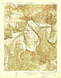 1945 Valhalla1945 Print · USGSThe Osage River valley in the mid-1940s is captured here just as rural life began to shift away from old river fords and camp settlements. Genealogists can locate Peaceful Home Cem, Valhalla P O, and family-named schools like Wright Creek Sch.
 - 1947 Map of Jefferson City, 1949 Print
 1947 Jefferson City1949 Print · USGSCentral Missouri and the northern Ozarks come into focus in this late 1940s survey of the river-and-rail landscape. Genealogists and historians can trace the growth of Jefferson City and Sedalia or locate family roots near Bagnell Dam and the Lake of the Ozarks.
 - 1947 Map of Lawrence, 1954 Print
 1947 Lawrence1954 Print · USGSEastern Kansas and western Missouri thrive in the late 1940s, showing a landscape defined by major river valleys and a dense railway network. Genealogists can trace family settlements from Lawrence to Greenwood and locate landmarks like Olathe Navy and Lake Lotawana.
 - 1950 Map of Lawrence
 1950 Lawrence1950 Print · USGSMid-century Kansas and Missouri come alive in this map of the river-valley corridors just as the interstate era was beginning. Researchers can trace the legacy of major rail lines like the Union Pacific RR and locate ancestral roots in towns from Lawrence to Harrisonville.
 - 1953 Map of Johnstown, 1954 Print
 1953 Johnstown1954 Print · USGSThe rural border of Henry and Bates counties is captured here in the early fifties, showing a landscape shaped by creek drainage and small farming hubs. Genealogists can locate family burial sites at St Ludger Cem and Poage Cem, or trace the old school districts at Johnstown Sch and Aurora Sch.2 unique versions available
 - 1953 Map of Gaines, 1955 Print
 1953 Gaines1955 Print · USGSHenry County in the early fifties shows a landscape of river-bottom farms and rural industry along the South Grand River. Genealogists and historians can trace local landmarks like Englewood Cem, the Wastell Mine, and several country schools including Freedom Sch.3 unique versions available
 - 1953 Map of Montrose, 1955 Print
 1953 Montrose1955 Print · USGSHenry County saw a distinct mix of rail-side commerce and coal extraction during the early fifties. You can trace family roots at St Ludgers Cem, locate rural schoolhouses like Glenwood Sch, and see the early footprint of the Strip Mines near Montrose.2 unique versions available
 - 1953 Map of Hartwell, 1955 Print
 1953 Hartwell1955 Print · USGSHenry County is captured here in the early fifties during a period of rural transition along the St Louis San Francisco railroad. Genealogists can trace family footprints at Hickory Grove Cem or locate the Enterprise Sch (Abandoned) and Marvin Sch.3 unique versions available
 - 1953 Map of Creighton, 1955 Print
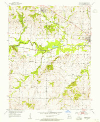 1953 Creighton1955 Print · USGSCreighton and Urich sat at a busy county-line junction in the early fifties, before the landscape was altered by modern river management. Genealogists can trace rural roots at Smoky Row Sch, Cove Creek Ch, and family burial grounds like Parker Cem.
 - 1953 Map of Calhoun East, 1955 Print
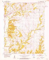 1953 Calhoun East1955 Print · USGSHenry County and the border of Benton County are captured in the early 1950s, showing a landscape of rural schoolhouses and prairie creek forks. Trace the old Missouri Kansas Texas rail line and find sites like Edgewood Sch, Oak Grove Ch, and Roseland.2 unique versions available
 - 1953 Map of Clinton South, 1955 Print
 1953 Clinton South1955 Print · USGSHenry County is captured in the early fifties, showing the convergence of river commerce and coal mining. Genealogists can locate family landmarks such as Oak Grove Grove Cem, Franklin Sch, and the riverside settlement of Deepwater.3 unique versions available
 - 1953 Map of Calhoun West, 1955 Print
 1953 Calhoun West1955 Print · USGSHenry County in the mid-fifties is captured here as a landscape of small farmsteads and rural school districts connected by the Missouri Kansas Texas railroad. Researchers can trace family history through sites like Drakes Chapel, Lewis, and the Deer Creek Sch.3 unique versions available
Showing maps 1-25 of 128
Top cities of Henry County
- Clinton historical maps
- Windsor historical maps
- Leesville historical maps
- Urich historical maps
- Calhoun historical maps
- Deepwater historical maps
See more
Frequently asked questions
- What are the different types of historical maps available for Henry County?
- What is the oldest map of Henry County?
- Where can I purchase historical maps of Henry County for my home or office?
- Where can I download high-res historical maps of Henry County?
- Are there historical topographic maps available for Henry County?
- Is there historical aerial imagery available for Henry County?
- Where are historical maps of Henry County sourced from?