
Loading...
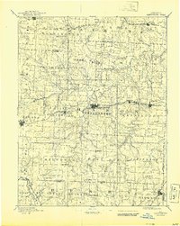
Loading map...1885 Map of Warrensburg
USGS Topo · Published 1954About this map
Warrensburg stands as the central hub of this 1880s landscape, serving as a vital rail junction where the Missouri Pacific Railroad Main Line meets the local industry of Carbon Hill. This reconnaissance survey documents Johnson County at a time when small agricultural settlements like Chilhowee, Post Oak, and Knobnoster were beginning to coalesce around a network of early railroads, including the Kansas City Osceola & Southern R.R. and the C. & A. R. R.
Find a feature on this map
66 named features on this map. Tap any name to fly to it.
Don’t see what you’re looking for? This feature index may not catch every label — zoom into the map to look around manually.
Map Details
Date Portrayed1885
Date Published1954
PublisherU.S. Geological Survey
Map TypeTopographic
Scale1:125,000
Physical Dimensions16.5 x 20.7 inches
Editions of this 1885 Warrensburg Map
This is the sole edition of this map. No revisions or reprints were ever made.
Historical Maps of Warrensburg Through Time
3 maps found

Featured Locations
Source Details
SourceU.S. Geological Survey
CopyrightPublic Domain