
1953 Map of Gaines
USGS Topo · Published 1955About this map
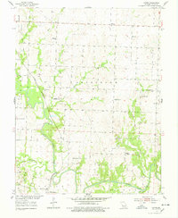
The South Grand River meanders across this mid-century landscape in Henry County, joined by numerous tributaries including Deepwater Creek, Sparrow Foot Creek, and Pretty Bob Creek. The area is characterized by a dense network of rural infrastructure, featuring several local educational and spiritual centers such as Richland Sch, Surprise Sch, and the Bethlehem Ch. Industry and transport are closely linked, with the St Louis San Francisco railroad line cutting through the terrain near Brownington, while the Wastell Mine and Hilty Mine point to the region's mineral extraction history.
Find a feature on this map
30 named features on this map. Tap any name to fly to it.
Don’t see what you’re looking for? This feature index may not catch every label — zoom into the map to look around manually.
Map Details
Editions of this 1953 Gaines Map
3 editions found
Other maps of this area

1887 · Clinton
USGS Topo · 1:125,000

1894 · Clinton
USGS Topo · 1:125,000

1941 · Valhalla
USGS Topo · 1:24,000

1941 · Lowry City
USGS Topo · 1:24,000

1945 · Lowry City
USGS Topo · 1:24,000
1945 · Valhalla
USGS Topo · 1:24,000

1947 · Jefferson City
USGS Topo · 1:250,000
1953 · Calhoun East
USGS Topo · 1:24,000

1953 · Clinton South
USGS Topo · 1:24,000

1953 · Calhoun West
USGS Topo · 1:24,000