
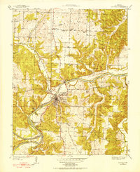
1945 Map of Valhalla
USGS Topo · Published 1945About this map
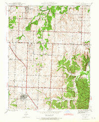
The Osage River and Grand River wind through this landscape at a time when river bends and fords still dictated local life and movement. This 1940s survey reveals a dispersed rural community centered around the Valhalla P O and Valhalla Store, before later water management projects altered the valley. The map is particularly rich for genealogical research, documenting numerous small burial grounds such as Peaceful Home Cem, Harris Bend Cem, and Gilbert Cem. Scattered schools like Mountain Home Sch and Wright Creek Sch reflect a traditional township-based educational system. Transportation is defined by river crossings and the early route of ST Highway 13, with specialized sites like Greys Mill Ford and White Sulphur Springs suggesting a landscape deeply tied to its natural hydrology and mineral resources.
Find a feature on this map
43 named features on this map. Tap any name to fly to it.
Don’t see what you’re looking for? This feature index may not catch every label — zoom into the map to look around manually.
Map Details
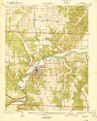
Editions of this 1945 Valhalla Map
This is the sole edition of this map. No revisions or reprints were ever made.
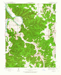
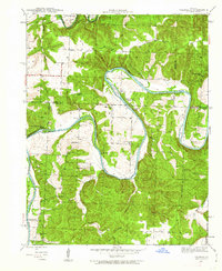
Other maps of this area

1887 · Clinton
USGS Topo · 1:125,000

1887 · Warsaw
USGS Topo · 1:125,000

1894 · Warsaw
USGS Topo · 1:125,000

1894 · Clinton
USGS Topo · 1:125,000

1936 · Shawnee Bend
USGS Topo · 1:24,000
1939 · Osceola
USGS Topo · 1:24,000
1940 · Osceola
USGS Topo · 1:24,000
1940 · Iconium
USGS Topo · 1:24,000
1941 · Valhalla
USGS Topo · 1:24,000
1941 · Lowry City
USGS Topo · 1:24,000