
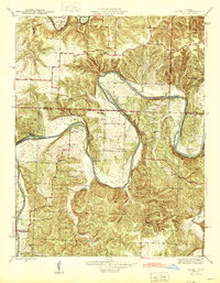
1936 Map of Shawnee Bend
USGS Topo · Published 1936About this map
The Lake of the Ozarks dominates this 1936 survey, showing the intricate, branching shoreline created by the impoundment of the Grand River and its many tributaries. The map captures the Benton County landscape as it adjusted to the newly formed reservoir, featuring the Long Shoal Bridge and prominent landmarks like Kasinger Bluff. Rural life is meticulously documented through a network of country schools such as Cherrydale Sch and Gern Hill Sch, along with community anchors like Shady Grove Ch and Hickory Chapel. To the southeast, the settlement of Warsaw sits at the edge of the rising waters, while the small community of Racket persists near the western edge. This era's terrain is defined by dramatic elevation changes at Devils Backbone and numerous hollows, including Crawfish Hollow and Wilson Hollow, which provided the natural drainage for this complex river system.
Find a feature on this map
39 named features on this map. Tap any name to fly to it.
Don’t see what you’re looking for? This feature index may not catch every label — zoom into the map to look around manually.
Map Details
Editions of this 1936 Shawnee Bend Map
This is the sole edition of this map. No revisions or reprints were ever made.
Other maps of this area

1887 · Clinton
USGS Topo · 1:125,000

1887 · Warsaw
USGS Topo · 1:125,000

1894 · Warsaw
USGS Topo · 1:125,000

1894 · Clinton
USGS Topo · 1:125,000

1935 · Dell
USGS Topo · 1:24,000

1936 · Schuyler
USGS Topo · 1:24,000

1941 · Valhalla
USGS Topo · 1:24,000

1945 · Fristoe
USGS Topo · 1:62,500
1945 · Valhalla
USGS Topo · 1:24,000

1947 · Jefferson City
USGS Topo · 1:250,000