
1941 Map of Lowry City
USGS Topo · Published 1965About this map
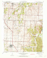
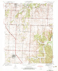
Lowry City and Brownington anchor this survey of the Missouri landscape at the dawn of the 1940s, a period when the rural economy was defined by a dense network of small school districts and country churches. The path of the St Louis San Francisco RR cuts diagonally through the terrain, connecting these rail-oriented settlements to the broader region. This area, straddling the Henry Co St Clair Co line, shows a landscape still partitioned into family-scale farms, punctuated by early industrial activity such as the Mine Dump near Cooper Creek. The drainage of the South Grand River and Big Muddy Creek dictates the topography, where numerous local landmarks like Landecker Ch and Diamond Point Sch served as the social centers for outlying residents. For those tracing family histories, the map identifies several local burials, including Maplewood Cem and Brownington Cem.
Find a feature on this map
29 named features on this map. Tap any name to fly to it.
Don’t see what you’re looking for? This feature index may not catch every label — zoom into the map to look around manually.
Map Details
Editions of this 1941 Lowry City Map
3 editions found
Other maps of this area

1887 · Clinton
USGS Topo · 1:125,000

1894 · Clinton
USGS Topo · 1:125,000

1938 · Monegaw Springs
USGS Topo · 1:24,000

1939 · Osceola
USGS Topo · 1:24,000

1940 · Osceola
USGS Topo · 1:24,000
1940 · Monegaw Springs
USGS Topo · 1:24,000

1940 · Iconium
USGS Topo · 1:24,000

1941 · Valhalla
USGS Topo · 1:24,000
1944 · Iconium
USGS Topo · 1:24,000

1945 · Lowry City
USGS Topo · 1:24,000