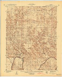
1940 Map of Monegaw Springs
USGS Topo · Published 1940About this map
Osage River winds through this rural landscape in St. Clair County, anchoring a terrain defined by many small rural school districts and family-named landmarks. The settlement of Monegaw Springs sits near the river's edge, characterized by local geography such as Youngers Lookout and Spring Lake. This 1938 survey illustrates a densely populated backcountry where small community centers like Chalk Level served as local hubs, each supported by its own institutions like the Chalk Level Ch and Chalk Level Sch.
Find a feature on this map
40 named features on this map. Tap any name to fly to it.
Don’t see what you’re looking for? This feature index may not catch every label — zoom into the map to look around manually.
Map Details
Editions of this 1940 Monegaw Springs Map
2 editions found
Other maps of this area

1886 · Stockton
USGS Topo · 1:125,000

1887 · Clinton
USGS Topo · 1:125,000

1894 · Clinton
USGS Topo · 1:125,000

1937 · Tiffin
USGS Topo · 1:31,680

1938 · Monegaw Springs
USGS Topo · 1:24,000

1938 · Roscoe
USGS Topo · 1:24,000

1938 · Vista
USGS Topo · 1:24,000

1938 · Taberville
USGS Topo · 1:24,000

1939 · Osceola
USGS Topo · 1:24,000

1940 · Taberville
USGS Topo · 1:24,000