
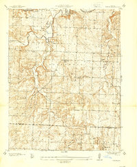
1937 Map of Tiffin
USGS Topo · Published 1937About this map
Tiffin and the rural townships of West Speedwell and East Speedwell define the landscape of St. Clair County during the late 1930s. The region is characterized by a dense network of one-room schoolhouses and country churches, reflecting a decentralized farming community. Notable landmarks include the Union Point Ch and its neighboring Union Point Sch, alongside several family and community burial grounds such as Landers Cem and Kennerly Cem.
Find a feature on this map
34 named features on this map. Tap any name to fly to it.
Don’t see what you’re looking for? This feature index may not catch every label — zoom into the map to look around manually.
Map Details
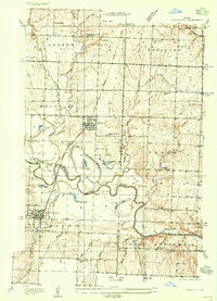
Editions of this 1937 Tiffin Map
2 editions found
Other maps of this area

1886 · Nevada
USGS Topo · 1:125,000

1886 · Stockton
USGS Topo · 1:125,000

1887 · Clinton
USGS Topo · 1:125,000

1887 · Butler
USGS Topo · 1:125,000

1894 · Butler
USGS Topo · 1:125,000

1894 · Nevada
USGS Topo · 1:125,000

1894 · Clinton
USGS Topo · 1:125,000
1934 · Rockville
USGS Topo · 1:24,000
1938 · Monegaw Springs
USGS Topo · 1:24,000
1938 · Roscoe
USGS Topo · 1:24,000