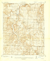
1937 Map of Tiffin
USGS Topo · Published 1937About this map
The Osage River meanders across the northern edge of this Missouri landscape, framed by prominent terrain features like Rock House Bluff. This 1930s survey captures a rural network of small communities and crossroads settlements, including Tiffin and Cedar Springs, during an era when local life revolved around a dense system of country schools and churches. The map reveals the distribution of family and community landmarks, such as Landers Cem and Pape Ch, which served the residents of West Speedwell and East Speedwell.
Find a feature on this map
31 named features on this map. Tap any name to fly to it.
Don’t see what you’re looking for? This feature index may not catch every label — zoom into the map to look around manually.
Map Details
Editions of this 1937 Tiffin Map
2 editions found
Other maps of this area

1886 · Nevada
USGS Topo · 1:125,000

1886 · Stockton
USGS Topo · 1:125,000

1887 · Clinton
USGS Topo · 1:125,000

1887 · Butler
USGS Topo · 1:125,000

1894 · Butler
USGS Topo · 1:125,000

1894 · Nevada
USGS Topo · 1:125,000

1894 · Clinton
USGS Topo · 1:125,000

1934 · Rockville
USGS Topo · 1:24,000

1937 · Tiffin
USGS Topo · 1:31,680

1938 · Monegaw Springs
USGS Topo · 1:24,000