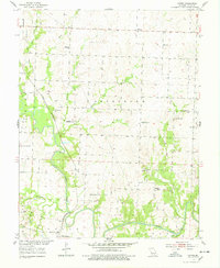
1953 Map of Gaines
USGS Topo · Published 1978About this map
Alberta and Gaines anchor this Missouri landscape, defined by the winding course of the South Grand River and its numerous tributaries. In the early 1950s, the region supported a dense network of rural infrastructure, including many neighborhood schools such as Freedom Sch, Pretty Bob Sch, and Richland Sch. The St Louis San Francisco railroad cuts diagonally across the terrain, serving the local economy and connecting the settlement of Brownington to the wider region.
Find a feature on this map
29 named features on this map. Tap any name to fly to it.
Don’t see what you’re looking for? This feature index may not catch every label — zoom into the map to look around manually.
Map Details
Editions of this 1953 Gaines Map
3 editions found
Other maps of this area

1887 · Clinton
USGS Topo · 1:125,000

1894 · Clinton
USGS Topo · 1:125,000

1941 · Valhalla
USGS Topo · 1:24,000

1941 · Lowry City
USGS Topo · 1:24,000

1945 · Lowry City
USGS Topo · 1:24,000
1945 · Valhalla
USGS Topo · 1:24,000

1947 · Jefferson City
USGS Topo · 1:250,000

1953 · Gaines
USGS Topo · 1:24,000
1953 · Calhoun East
USGS Topo · 1:24,000

1953 · Clinton South
USGS Topo · 1:24,000