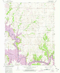
1953 Map of Gaines
USGS Topo · Published 1982About this map
The South Grand River and its major tributaries, including Deepwater Creek and Sparrow Foot Creek, define the landscape south of Clinton during a period of significant hydrological change. Revisions from the early 1980s highlight the emergence of the Harry S Truman Reservoir, shown overlaying the original river valley and affecting land use in the Bethlehem township area.
Find a feature on this map
34 named features on this map. Tap any name to fly to it.
Don’t see what you’re looking for? This feature index may not catch every label — zoom into the map to look around manually.
Map Details
Editions of this 1953 Gaines Map
3 editions found
Other maps of this area

1887 · Clinton
USGS Topo · 1:125,000

1894 · Clinton
USGS Topo · 1:125,000

1941 · Valhalla
USGS Topo · 1:24,000

1941 · Lowry City
USGS Topo · 1:24,000

1945 · Lowry City
USGS Topo · 1:24,000
1945 · Valhalla
USGS Topo · 1:24,000

1947 · Jefferson City
USGS Topo · 1:250,000

1953 · Gaines
USGS Topo · 1:24,000
1953 · Calhoun East
USGS Topo · 1:24,000

1953 · Clinton South
USGS Topo · 1:24,000