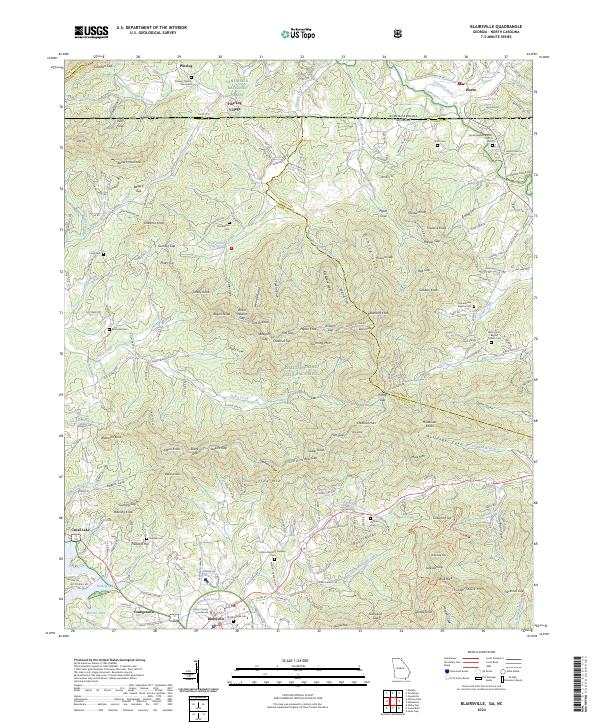
2024 Map of Blairsville
USGS Topo · Published 2024About this map
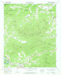
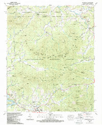
Blairsville serves as the focal point for this study of the north Georgia mountains, anchored by the Union County Courthouse and the nearby Old Blairsville Cem. The landscape is defined by the high ridges of the Chattahoochee National Forest and Nantahala National Forest, where the terrain is punctuated by numerous gaps such as Ballard Gap and White Walnut Gap. To the north, the settlement of Pine Log Village and the Pinelog Church graveyard reflect the area's rural history near the Georgia-North Carolina border. Water features like Nottely Lake and Butternut Creek carve through the valleys, while family-named landmarks like Henderson Cem and Hunt Cem provide essential data points for local genealogists. The map also documents the transition from mountain gaps to developed corridors along Old HWY 64 W and Industrial Blvd.
Find a feature on this map
184 named features on this map. Tap any name to fly to it.
Don’t see what you’re looking for? This feature index may not catch every label — zoom into the map to look around manually.
Map Details
Editions of this 2024 Blairsville Map
This is the sole edition of this map. No revisions or reprints were ever made.
Historical Maps of Pine Log Village Through Time
3 maps found