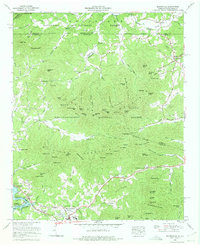
1966 Map of Blairsville
USGS Topo · Published 1975About this map
Blairsville serves as the focal point of this North Georgia mountain landscape, shown just after the mid-1960s. The town's layout includes civic landmarks like the Union County High School and Haralson Recreation Center, while the surrounding terrain is heavily defined by the boundaries of the Nantahala National Forest and Chattahoochee National Forest. To the south, the Nottely River feeds into Nottely Lake and Canal Lake, reflecting the hydroelectric and recreational development of the era.
Find a feature on this map
120 named features on this map. Tap any name to fly to it.
Don’t see what you’re looking for? This feature index may not catch every label — zoom into the map to look around manually.
Map Details
Editions of this 1966 Blairsville Map
2 editions found
Other maps of this area

1886 · Dahlonega
USGS Topo · 1:125,000

1888 · Ellijay
USGS Topo · 1:125,000

1892 · Dahlonega
USGS Topo · 1:125,000

1892 · Ellijay
USGS Topo · 1:125,000

1893 · Murphy
USGS Topo · 1:125,000

1896 · Dahlonega
USGS Topo · 1:125,000

1898 · Ellijay
USGS Topo · 1:125,000

1903 · Dahlonega
USGS Topo · 1:125,000

1911 · Ellijay
USGS Topo · 1:125,000

1914 · Murphy
USGS Topo · 1:125,000