
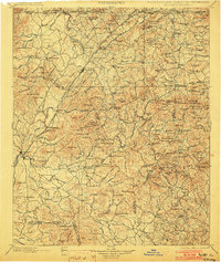
1898 Map of Ellijay
USGS Topo · Published 1898About this map
The mountain town of Ellijay serves as the focal point for this late nineteenth-century landscape where the Cartecay River and Tickanetley Creek converge. The survey reveals an era before major highway development, when the regional economy relied heavily on the Atlanta Knoxville and Northern RR and numerous river crossings like Bakers Ferry and the Scavenger Bridge. The northern reaches of the map show the industrial footprint of an Iron Mine near the tri-state boundary where Georgia, North Carolina, and Tennessee meet.
Find a feature on this map
201 named features on this map. Tap any name to fly to it.
Don’t see what you’re looking for? This feature index may not catch every label — zoom into the map to look around manually.
Map Details
Editions of this 1898 Ellijay Map
2 editions found
Other maps of this area

1886 · Dalton
USGS Topo · 1:125,000

1886 · Cleveland
USGS Topo · 1:125,000

1886 · Dahlonega
USGS Topo · 1:125,000

1888 · Ellijay
USGS Topo · 1:125,000

1890 · Suwanee
USGS Topo · 1:125,000

1890 · Cartersville
USGS Topo · 1:125,000

1891 · Gainesville
USGS Topo · 1:125,000

1891 · Cartersville
USGS Topo · 1:125,000

1892 · Dahlonega
USGS Topo · 1:125,000

1892 · Cleveland
USGS Topo · 1:125,000