2023 Map of Blandburg
USGS Topo · Published 2023About this map
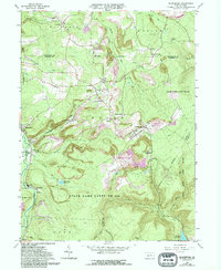
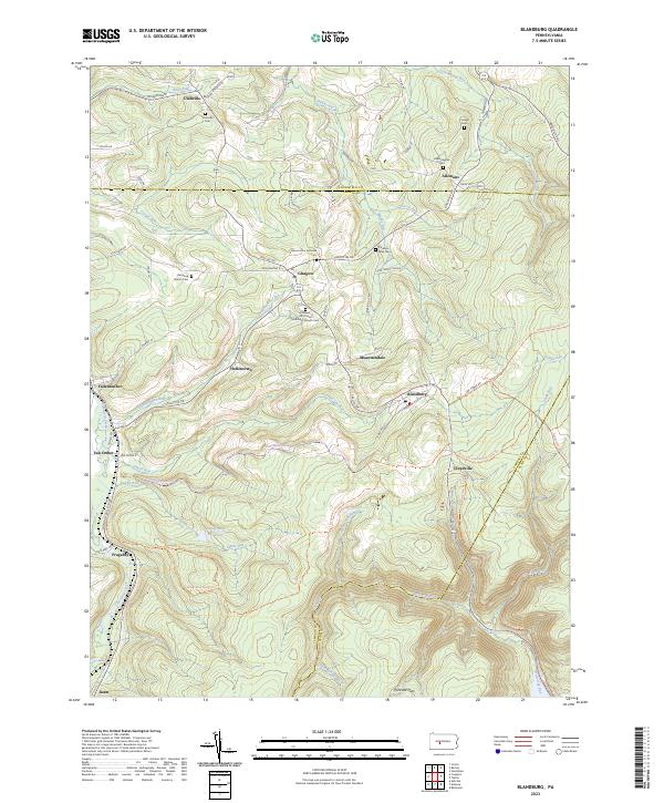
Blandburg and the surrounding highlands of the Allegheny Front are defined by a complex network of narrow valleys and ridge-top settlements. This modern survey illustrates a landscape where early industrial infrastructure has been repurposed for recreation, most notably the Bells Gap Rail Trl, which follows the historic path of the Bells Gap Railroad into the mountains. Small hamlets like Glasgow, Utahville, and Allemans are clustered along the northern reaches, while the southern terrain is dominated by the catchments for the Sandy Run Reservoir.
Find a feature on this map
70 named features on this map. Tap any name to fly to it.
Don’t see what you’re looking for? This feature index may not catch every label — zoom into the map to look around manually.
Map Details
Editions of this 2023 Blandburg Map
This is the sole edition of this map. No revisions or reprints were ever made.