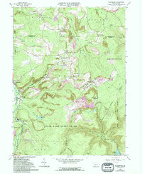
1963 Map of Blandburg
USGS Topo · Published 1994About this map
Blandburg and its surrounding coal-country settlements define this portion of the Allegheny Plateau during a period of significant environmental transition. The landscape is heavily marked by the legacy of extraction, showing a complex network of Strip Mines and several areas specifically identified as a Reclaimed Strip Mine. These industrial sites are interspersed with small communities such as Glasgow, Mountaindale, and Fallentimber, many of which were founded around the local mining and timber economies. The transport of these resources is evidenced by the Pennsylvania RR corridor winding through the valleys alongside Powell Run.
Find a feature on this map
58 named features on this map. Tap any name to fly to it.
Don’t see what you’re looking for? This feature index may not catch every label — zoom into the map to look around manually.
Map Details
Editions of this 1963 Blandburg Map
4 editions found
Other maps of this area

1902 · Patton
USGS Topo · 1:62,500

1903 · Curwensville
USGS Topo · 1:62,500

1903 · Houtzdale
USGS Topo · 1:62,500

1904 · Patton
USGS Topo · 1:62,500

1905 · Houtzdale
USGS Topo · 1:62,500

1920 · Altoona
USGS Topo · 1:62,500

1922 · Altoona
USGS Topo · 1:62,500

1939 · Curwensville
USGS Topo · 1:62,500

1942 · Curwensville
USGS Topo · 1:62,500

1943 · Punxsutawney
USGS Topo · 1:125,000
Featured Places
- Beccaria Township, PA
- Dean Township, PA
- Clearfield Township, PA
- Gulich Township, PA
- Utahville, Beccaria Township