
1903 Map of Houtzdale
USGS Topo · Published 1959About this map
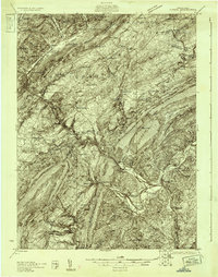
Houtzdale and the surrounding coal-country plateaus are documented here during a period of intense industrial activity at the turn of the century. The map reveals an intricate network of competing rail lines, including the Pa. R. R. and the Clearfield and Southern R. R., which serve numerous small company towns and junctions like Goss Run Junc. and Banan Junc.. These tracks follow the winding paths of Clearfield Creek and the West Branch Susquehanna River, which dominate the western portion of the quadrangle.
Find a feature on this map
107 named features on this map. Tap any name to fly to it.
Don’t see what you’re looking for? This feature index may not catch every label — zoom into the map to look around manually.
Map Details
Editions of this 1903 Houtzdale Map
This is the sole edition of this map. No revisions or reprints were ever made.
Other maps of this area

1902 · Patton
USGS Topo · 1:62,500

1903 · Curwensville
USGS Topo · 1:62,500

1904 · Patton
USGS Topo · 1:62,500

1905 · Houtzdale
USGS Topo · 1:62,500

1920 · Altoona
USGS Topo · 1:62,500

1922 · Philipsburg
USGS Topo · 1:62,500

1922 · Altoona
USGS Topo · 1:62,500

1923 · Tyrone
USGS Topo · 1:62,500
1929 · Tyrone
USGS Topo · 1:48,000

1929 · Karthaus
USGS Topo · 1:62,500