Old Maps of Clearfield County, Pennsylvania
Explore 122 old maps of Clearfield County, spanning from 1902 to today. These high-resolution historic maps reveal how streets, neighborhoods, landmarks, and natural features evolved over time — perfect for genealogy, metal detecting, research, and local history exploration.
What you can do with these maps:
- See how Clearfield County changed over time: Compare historical maps to modern-day views to trace roads, homesites, rail lines & more.
- View detailed metadata: Each map includes creators, publishers, year, scale, and archive source.
- Overlay maps with satellite & LiDAR: Visualize the past alongside modern tools to explore terrain & human change.
- Trusted historical sources: Maps sourced from the USGS, Library of Congress, and other archives.
- Access maps your way: View online, download high-res files, or order prints for personal or research use.
Start exploring old maps of Clearfield County to uncover forgotten places, hidden landmarks, and the deep history beneath your feet.
Clearfield County, PA maps
(122)- 1902 Map of Patton, 1955 Print
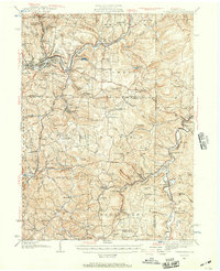
 1902 Patton1955 Print · USGSThe northern Cambria County coal and timber country is captured here at the turn of the century, as mountain railroads reached their peak influence. Researchers can trace historic industrial sites like Eckenrode Mill and early settlements including St Bonifacius and Patton.
 - 1902 Map of Barnesboro, 1956 Print
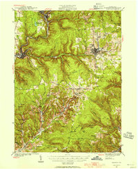
 1902 Barnesboro1956 Print · USGSIndiana and Cambria counties are documented here at a peak of rail and coal development. Genealogists and historians can trace family roots through numerous small settlements like Possum Glory and Nicktown or follow the Pennsylvania RR through the bustling streets of Barnesboro.
 - 1903 Map of Curwensville
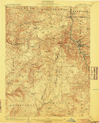
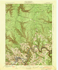
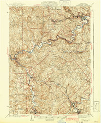
 1903 Curwensville1903 Print · USGSThe West Branch Susquehanna River region was a hub of timber and rail activity in the early twentieth century. Researchers can trace the development of riverside towns like Lumber City, locate the Wister Mine near Irvona, and follow the winding routes of the New York Central and Hudson River RR.4 unique versions available
 - 1903 Map of Houtzdale, 1959 Print
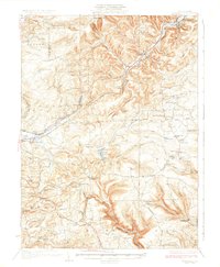
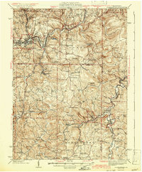
 1903 Houtzdale1959 Print · USGSClearfield County was a hub of rail and river activity at the turn of the century as industrial towns expanded along the Allegheny Mts. Researchers can trace the early layout of Houtzdale, find family-named post offices like Oshanter P.O. Mitchells, and follow the winding Clearfield Creek.
 - 1904 Map of Barnesboro
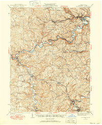
 1904 Barnesboro1904 Print · USGSNorthwestern Cambria County was a hub of river and rail activity at the turn of the century, as the coal industry took hold. Genealogists can trace family names and small settlements from Barnesboro and Cherrytree to remote outposts like Strongstown and Nolo.5 unique versions available
 - 1904 Map of Patton
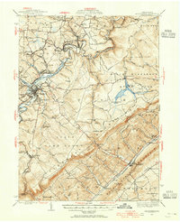
 1904 Patton1904 Print · USGSCambria County at the start of the century is a network of rail lines and coal settlements, anchored by the growth of Patton. Genealogists can trace family roots through historic sites like St Bonifacius, Chest Springs, and the industrial Mitchell Mines.5 unique versions available
 - 1905 Map of Houtzdale
 1905 Houtzdale1905 Print · USGSHoutzdale and the surrounding Clearfield County coalfields are captured here during their industrial prime at the turn of the century. Genealogists and historians can trace rail-dependent settlements and local post offices like Kephart P.O., Belsena Mills, and Brisbin.5 unique versions available
 - 1906 Map of Punxsutawney
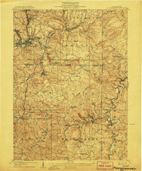 1906 Punxsutawney1906 Print · USGSPunxsutawney and the surrounding coal townships of the early 1900s are captured here at the height of the region's industrial growth. Genealogists and historians can trace the specific locations of historic post offices like Adrian and Gettysburg alongside family-named sites such as Bella Mills.4 unique versions available
 - 1920 Map of Altoona, 1954 Print
 1920 Altoona1954 Print · USGSThe industrial and rail-heavy corridor of the 1920s is on full display as the Pennsylvania RR cuts through the mountains. Genealogists and local historians can trace family roots through numerous country schools like Beech Grove School and lost settlements such as Wopsononock or Fostoria.6 unique versions available
 - 1922 Map of Philipsburg
 1922 Philipsburg1922 Print · USGSPhilipsburg and the northern Allegheny coalfields are captured here in the early twenties during a period of heavy rail and mining activity. Genealogists can trace family locations through dozens of named rural schoolhouses like Klondike School and industrial sites including Cuba Mines and the Central RR of Pennsylvania.3 unique versions available
 - 1922 Map of Altoona
 1922 Altoona1922 Print · USGSThe industrial hub of Altoona and the steep slopes of the Allegheny Front are captured here in the early 1920s. Researchers can trace the extensive rail operations of the Pennsylvania railroad and locate numerous vanished rural landmarks like the Richland School and Grandview Cemetery.8 unique versions available
 - 1922 Map of Du Bois, 1957 Print
 1922 Du Bois1957 Print · USGSJefferson and Clearfield Counties are shown during the height of the region's mining and rail era in the early twenties. Genealogists and researchers can trace family lands near Eleanora Mines, rural schools like Mason School, and stops along the Pittsburg and Shawmut railroad.2 unique versions available
 - 1924 Map of Du Bois
 1924 Du Bois1924 Print · USGSJefferson and Clearfield Counties were at the heart of the Pennsylvania coal and rail economy in the early twenties. Genealogists and historians can trace dozens of small settlements and local schoolhouses like Allens Mills, Soldier PO, and the Beechwoods School.5 unique versions available
 - 1929 Map of Karthaus
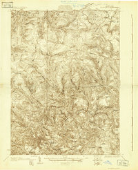
 1929 Karthaus1929 Print · USGSThe West Branch Susquehanna River and its steep hollows defined life in Clearfield County during the late twenties. Researchers can trace the riverfront New York Central Railroad and find dozens of rural school sites like Fairview Sch and the community at Frenchville.3 unique versions available
 - 1929 Map of Clearfield
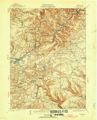
 1929 Clearfield1929 Print · USGSThe riverfront and rail lines of central Pennsylvania come alive in this late 1920s survey of the West Branch Susquehanna River valley. Genealogists and historians can trace the foundations of local society through landmarks like the Leonard Waterford Sch and the rural crossroads of LeContes Mills.2 unique versions available
 - 1929 Map of Penfield, 1954 Print
 1929 Penfield1954 Print · USGSCentral Pennsylvania's rugged plateau and coal regions are mapped here in the late twenties, showing the intersection of major rail lines and isolated mountain communities. Genealogists can locate family landmarks like the Hoover Farm and several vanished rural schoolhouses including Hickory Sch and Laborde Sch.3 unique versions available
 - 1932 Map of Clearfield
 1932 Clearfield1932 Print · USGSClearfield and the West Branch of the Susquehanna are captured here in the early 1930s as a vital hub of rail and river industry. Researchers can trace ancestral locations through numerous rural landmarks like Lecontes Mills, Goshen Ch, and Mt Sinai Sch.4 unique versions available
 - 1932 Map of Penfield
 1932 Penfield1932 Print · USGSClearfield County is shown in the early thirties at a time when mountain railroads and forest management defined the region. Local historians can trace the paths of the Pennsylvania RR through Penfield or locate schools such as Coal Hill Sch and Hickory Sch.3 unique versions available
 - 1932 Map of Karthaus
 1932 Karthaus1932 Print · USGSThe Susquehanna’s West Branch winds through Clearfield and Centre Counties in the late 1920s, a landscape shaped by the rail and timber industries. Genealogists can trace family names through dozens of rural schools and churches like Mignot Sch and Fairview Ch.3 unique versions available
 - 1939 Map of Curwensville, 1952 Print
 1939 Curwensville1952 Print · USGSClearfield County in the late 1930s is defined by a dense rail-and-river network where the West Branch of the Susquehanna meets Curwensville. Local historians can trace dozens of rural schoolhouses and family burial sites like Friends Cem and Glendale Sch.2 unique versions available
 - 1939 Map of Philipsburg, 1955 Print
 1939 Philipsburg1955 Print · USGSCentral Pennsylvania’s coal and iron country is captured here during the late thirties, showing the rail-linked settlements of the Moshannon Valley. Researchers can trace family roots at Black Oak Sch, find old industrial sites like Martha Furnace, or locate the Rusnak Mine.2 unique versions available
 - 1939 Map of Punxsutawney, 1957 Print
 1939 Punxsutawney1957 Print · USGSPunxsutawney and the surrounding coal-and-rail country appear here in the years leading up to World War II. Genealogists and historians can trace defunct school districts like Harmony Thomas Sch, early rail junctions in Cloe, and burial sites at Fairview Cem.2 unique versions available
 - 1941 Map of Ridgway, 1956 Print
 1941 Ridgway1956 Print · USGSElk County at the start of the 1940s reveals a landscape shaped by coal mining and heavy rail industry. Genealogists can locate family homes near Dagus Mines or trace the early foundations of Ridgway and St. Marys.2 unique versions available
 - 1942 Map of Curwensville
 1942 Curwensville1942 Print · USGSClearfield County settlements and river-side industries are documented here in the early years of the war. Genealogists and historians can trace family roots through landmarks like Fruit Hill Ch, Friends Cem, and the Oakland Sch in the hills above the Susquehanna River.
 - 1942 Map of Punxsutawney
 1942 Punxsutawney1942 Print · USGSWest-central Pennsylvania during the early war years reveals a landscape shaped by rail transport and deep-rooted rural communities. Researchers can trace the legacy of local education and industry through dozens of named sites like Harmony Thomas School, McGees Mills, and Bells Mills.2 unique versions available
Showing maps 1-25 of 122
Top cities of Clearfield County
- Sandy Township historical maps
- DuBois historical maps
- Clearfield historical maps
- Curwensville historical maps
- Beccaria Township historical maps
- Osceola Mills historical maps
See more
Frequently asked questions
- What are the different types of historical maps available for Clearfield County?
- What is the oldest map of Clearfield County?
- Where can I purchase historical maps of Clearfield County for my home or office?
- Where can I download high-res historical maps of Clearfield County?
- Are there historical topographic maps available for Clearfield County?
- Is there historical aerial imagery available for Clearfield County?
- Where are historical maps of Clearfield County sourced from?