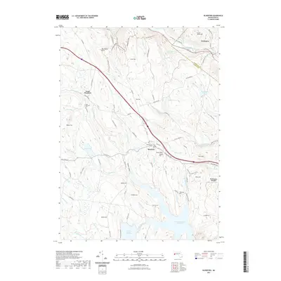
2021 Map of Blandford
USGS Topo · Published 2021About this map
Blandford and its surrounding heights occupy this high-elevation landscape within the Berkshire foothills, captured as modern infrastructure meets long-established rural settlements. The topography is defined by a series of prominent peaks and hollows, including Pudding Hill, Great Moose Hill, and the uniquely named The Volcanic Crater near the northern boundary. Water management is a central theme of the geography, with the large Borden Brook Reservoir and the northern tip of the Cobble Mountain Reservoir anchoring the southern terrain, while the Huntington Reservoir sits tucked into the northeastern corner. Historical connectivity is traced through several cemeteries such as North Blandford Cem and Warfield Cem, alongside a network of specialized routes like the C C C Ski Trl and the Beulah Land Road Trl. The map details the transition from the village center of Blandford to more remote settlements like North Blandford and the scout-affiliated area of Woronoco Heights.
Find a feature on this map
108 named features on this map. Tap any name to fly to it.
Don’t see what you’re looking for? This feature index may not catch every label — zoom into the map to look around manually.
Map Details
Editions of this 2021 Blandford Map
This is the sole edition of this map. No revisions or reprints were ever made.
Other maps of this area

1886 · Chesterfield
USGS Topo · 1:62,500

1886 · Becket
USGS Topo · 1:62,500

1887 · Granville
USGS Topo · 1:62,500

1888 · Becket
USGS Topo · 1:62,500

1888 · Sandisfield
USGS Topo · 1:62,500

1888 · Chesterfield
USGS Topo · 1:62,500

1889 · Granville
USGS Topo · 1:62,500

1893 · Granville
USGS Topo · 1:62,500

1893 · Chesterfield
USGS Topo · 1:62,500

1893 · Becket
USGS Topo · 1:62,500