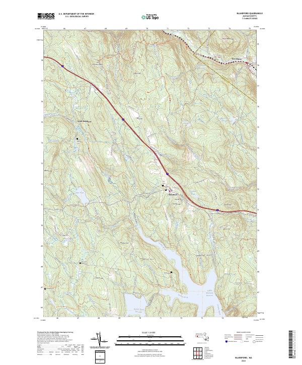
2024 Map of Blandford
USGS Topo · Published 2024About this map
Blandford and North Blandford anchor this highland landscape in the eastern foothills of the Berkshires, defined by steep ridges and significant water management infrastructure. The southern portion of the map is dominated by the vast reaches of Borden Brook Reservoir and Cobble Mountain Reservoir, which dramatically altered the drainage of Borden Brook and Middle Brook upon their completion. In the north, the Westfield Wild and Scenic River carves a deep valley near Huntington, bordered by Great Moose Hill and Green Hill. Genealogy researchers will find several small burial grounds scattered across the terrain, including Hubbard Cem, Warfield Cem, and the Stannard Road Cem. A geological curiosity, The Volcanic Crater, sits in the northwest quadrant near Beulah Land Road Trl, highlighting the complex ancient geography that shaped this part of Hampden County.
Find a feature on this map
109 named features on this map. Tap any name to fly to it.
Don’t see what you’re looking for? This feature index may not catch every label — zoom into the map to look around manually.
Map Details
Editions of this 2024 Blandford Map
This is the sole edition of this map. No revisions or reprints were ever made.
Other maps of this area

1886 · Chesterfield
USGS Topo · 1:62,500

1886 · Becket
USGS Topo · 1:62,500

1887 · Granville
USGS Topo · 1:62,500

1888 · Becket
USGS Topo · 1:62,500

1888 · Sandisfield
USGS Topo · 1:62,500

1888 · Chesterfield
USGS Topo · 1:62,500

1889 · Granville
USGS Topo · 1:62,500

1893 · Granville
USGS Topo · 1:62,500

1893 · Chesterfield
USGS Topo · 1:62,500

1893 · Becket
USGS Topo · 1:62,500